
Bailey Retreat
City/town information
Bailey is a small Highway 285 town located about 45 minutes southwest of Denver. There are a few restaurants and shops in town, as well as a couple gas stations.
This Platte Canyon town lies at 7,739 feet. It’s the eastern most town in Park County. The main part of town resides at the bottom of a steep winding section of Highway 285.
22 íbúar mæla með
Bailey
Bailey is a small Highway 285 town located about 45 minutes southwest of Denver. There are a few restaurants and shops in town, as well as a couple gas stations.
This Platte Canyon town lies at 7,739 feet. It’s the eastern most town in Park County. The main part of town resides at the bottom of a steep winding section of Highway 285.
Food scene
285 Pizza Pies
1 Delwood DrOlga's Eatery
60 B Bull Dogger DriveComfort Food, American, Fried Chicken. Call for hours: 720-602-7871
The Yum Bus
32 Bull Dogger DriveHighly rated sandwiches and fries. Order pickup: https://theyumbus.square.site/
We invite you to come try our family recipes of 35+ years. Our parents opened a Chinese restaurant in San Francisco, California in 1985 and we have since then used the same recipes to open Chinese restaurants in Colorado.
10 íbúar mæla með
Golden Pine Chinese
67348 US Highway 285We invite you to come try our family recipes of 35+ years. Our parents opened a Chinese restaurant in San Francisco, California in 1985 and we have since then used the same recipes to open Chinese restaurants in Colorado.
Traditional Hispanic food at its finest!! Been known to the lucky locals for years, but it's time to expand & share these family recipes!! Open for breakfast!
Sophia’s Mexican Food
43 Mount Evans BoulevardTraditional Hispanic food at its finest!! Been known to the lucky locals for years, but it's time to expand & share these family recipes!! Open for breakfast!
Rustic Station serves up delicious American cuisine. We are proud to offer many house specialties. Our food is cooked to order and prepared from scratch from the freshest ingredients. We pride ourselves in serving delectable food in a friendly and inviting atmosphere. Come by for our daily specials, we are constantly trying new items to keep the menu original and current.
35 íbúar mæla með
Rustic Station Restaurant
1 Co Rd 68Rustic Station serves up delicious American cuisine. We are proud to offer many house specialties. Our food is cooked to order and prepared from scratch from the freshest ingredients. We pride ourselves in serving delectable food in a friendly and inviting atmosphere. Come by for our daily specials, we are constantly trying new items to keep the menu original and current.
Riverbend Eatery is an Italian restaurant in Bailey, Colorado. We serve fresh Italian & American cuisine with a great view of the river. Dinner only.
25 íbúar mæla með
Riverbend Eatery
60006 US Hwy 285Riverbend Eatery is an Italian restaurant in Bailey, Colorado. We serve fresh Italian & American cuisine with a great view of the river. Dinner only.
Self proclaimed - Best burgers in Bailey!* Hearty Chili! Healthy Salads! Filling Breakfasts! Kids Menu!.
5 star reviews.
40 íbúar mæla með
Cut Throat Cafe
157 Main StSelf proclaimed - Best burgers in Bailey!* Hearty Chili! Healthy Salads! Filling Breakfasts! Kids Menu!.
5 star reviews.
Hiking
Explore this 9.00 mile, out and back trail near Shawnee, Colorado. Generally considered a moderately challenging route, it takes an average of 5 h 10 min to complete. This is a very popular area for birding, hiking, and horseback riding, so you'll likely encounter other people while exploring. The best times to visit this trail are March through October. Dogs are welcome, but must be on a leash.
8 íbúar mæla með
Meridian Trailhead
Explore this 9.00 mile, out and back trail near Shawnee, Colorado. Generally considered a moderately challenging route, it takes an average of 5 h 10 min to complete. This is a very popular area for birding, hiking, and horseback riding, so you'll likely encounter other people while exploring. The best times to visit this trail are March through October. Dogs are welcome, but must be on a leash.
From easy two-mile loops to challenging hikes that will take you all day to explore, Staunton State Park has a lot to offer hikers, and it’s a mere 15 minutes away from Bailey. One of the standout hikes here is the trail that leads to the Elk Falls Waterfall. At 12 miles round-trip, it takes a commitment, but is well worth the trek.
107 íbúar mæla með
Staunton ríkisvæði
12102 South Elk Creek RoadFrom easy two-mile loops to challenging hikes that will take you all day to explore, Staunton State Park has a lot to offer hikers, and it’s a mere 15 minutes away from Bailey. One of the standout hikes here is the trail that leads to the Elk Falls Waterfall. At 12 miles round-trip, it takes a commitment, but is well worth the trek.
This is a gorgeous trail even by Colorado’s high standards. At five and a half miles of easy conditions, this hike offers views of craggy rock formations, pristine alpine lakes, towering peaks, and bucolic streams. In the fall, it’s a stellar option to view aspen foliage on a trail that’s far less crowded than the nearby Colorado.
Burning Bear Trailhead #601
Geneva RoadThis is a gorgeous trail even by Colorado’s high standards. At five and a half miles of easy conditions, this hike offers views of craggy rock formations, pristine alpine lakes, towering peaks, and bucolic streams. In the fall, it’s a stellar option to view aspen foliage on a trail that’s far less crowded than the nearby Colorado.
Located on the south end of the Guanella Pass, the Shelf Lake Trail is steep in sections, which makes it moderately difficult to hike. The signage indicates it takes three and a half miles to reach Shelf Lake, but some hikers report hiking longer than that.
Shelf Lake Trailhead
County Road 1038Located on the south end of the Guanella Pass, the Shelf Lake Trail is steep in sections, which makes it moderately difficult to hike. The signage indicates it takes three and a half miles to reach Shelf Lake, but some hikers report hiking longer than that.
Located right outside of the main part of Bailey, the out and back Brookside-MCcurdy Trail clocks in at nearly 15 miles and is considered a challenging hike for its steep inclines and rocky conditions. It’s open during the winter months, but you won’t want to try hiking here without the appropriate gear if you visit between November and May.
For being so close to Bailey, this trail is generally uncrowded, especially the further in you hike. You’ll encounter open meadows, thick forests, and enchanting streams.
7 íbúar mæla með
Brookside-McCurdy Trailhead
Located right outside of the main part of Bailey, the out and back Brookside-MCcurdy Trail clocks in at nearly 15 miles and is considered a challenging hike for its steep inclines and rocky conditions. It’s open during the winter months, but you won’t want to try hiking here without the appropriate gear if you visit between November and May.
For being so close to Bailey, this trail is generally uncrowded, especially the further in you hike. You’ll encounter open meadows, thick forests, and enchanting streams.
Ideal for novices and expert hikers alike, Pine Valley Ranch Park has multiple hikes to choose from. Just over a mile and a half, the Narrow Gauge and North Fork View Loop is an easy hike that follows alongside the North Fork of the South Platte River. But on the other end of the hiking difficulty spectrum, the 18.5-mile Buffalo Creek Loop is a difficult hike filled with pristine views, wildflowers, and stately meadows.
Many hikers split this trail into three-day backpacking excursions.
27 íbúar mæla með
Pine Valley Ranch Park
30400 Crystal Lake RdIdeal for novices and expert hikers alike, Pine Valley Ranch Park has multiple hikes to choose from. Just over a mile and a half, the Narrow Gauge and North Fork View Loop is an easy hike that follows alongside the North Fork of the South Platte River. But on the other end of the hiking difficulty spectrum, the 18.5-mile Buffalo Creek Loop is a difficult hike filled with pristine views, wildflowers, and stately meadows.
Many hikers split this trail into three-day backpacking excursions.
Airbnb is labeling this Tanglewood Trails - However, Dear Creek Trail is the correct name. Just 20 minutes north of town, this popular trail delivers hikers through the Mt. Evans Wilderness to the boundary between the Pike and Arapaho national forests. It’s considered to be moderately difficult, and hikers should bring adequate clothing and supplies since the trail will take them to elevations of 13,000 feet.
Despite the inevitable weekend crowds, it’s still a place where it’s possible to see moose, bear, and other wildlife. The Deer Creek Trail might be too crowded for some, but it’s a well-maintained trek that has lots of scenery to offer.
17 íbúar mæla með
Tanglewood trails
8704-8798 Deer Creek RdAirbnb is labeling this Tanglewood Trails - However, Dear Creek Trail is the correct name. Just 20 minutes north of town, this popular trail delivers hikers through the Mt. Evans Wilderness to the boundary between the Pike and Arapaho national forests. It’s considered to be moderately difficult, and hikers should bring adequate clothing and supplies since the trail will take them to elevations of 13,000 feet.
Despite the inevitable weekend crowds, it’s still a place where it’s possible to see moose, bear, and other wildlife. The Deer Creek Trail might be too crowded for some, but it’s a well-maintained trek that has lots of scenery to offer.
Sightseeing
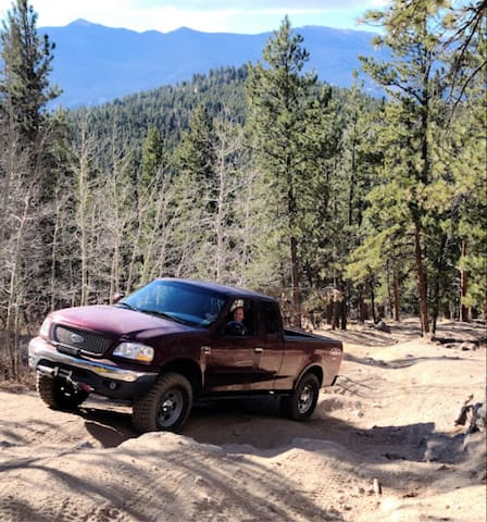
Discover this 11.20 mile, loop trail near Bailey, Colorado. Generally considered a challenging route, it takes an average of 5 h 51 min to complete. This is a popular trail for camping and off-road driving, but you can still enjoy some solitude during quieter times of day. The best times to visit this trail are March through November. Dogs are welcome and may be off-leash in some areas.
Slaughterhouse Trail Head
Discover this 11.20 mile, loop trail near Bailey, Colorado. Generally considered a challenging route, it takes an average of 5 h 51 min to complete. This is a popular trail for camping and off-road driving, but you can still enjoy some solitude during quieter times of day. The best times to visit this trail are March through November. Dogs are welcome and may be off-leash in some areas.
The Guanella Pass Scenic Byway is a great introduction to Colorado's Rocky Mountains. Climbing to timberline, the byway takes in views of 14,060-foot Mount Bierstadt and the alpine tundra before descending into cool groves of aspen and pine, as well as the historic town of Georgetown.
72 íbúar mæla með
Guanella Pass
The Guanella Pass Scenic Byway is a great introduction to Colorado's Rocky Mountains. Climbing to timberline, the byway takes in views of 14,060-foot Mount Bierstadt and the alpine tundra before descending into cool groves of aspen and pine, as well as the historic town of Georgetown.
Designated as a Wilderness Area by the United States Congress in 1980, the Lost Creek Wilderness now contains over 110,000 acres of land, all of which is located in Colorado. The Lost Creek Wilderness can be found within the Pike National Forest.
The name of the wilderness area was taken from Lost Creek, which was designated as a National National Landmark in 1966 and is called the Lost Creek Scenic Area. The natural landmark itself got its name from the fact that Lost Creek has a tendency to disappear underground and reappear downstream.
15 íbúar mæla með
Lost Creek Wilderness
Designated as a Wilderness Area by the United States Congress in 1980, the Lost Creek Wilderness now contains over 110,000 acres of land, all of which is located in Colorado. The Lost Creek Wilderness can be found within the Pike National Forest.
The name of the wilderness area was taken from Lost Creek, which was designated as a National National Landmark in 1966 and is called the Lost Creek Scenic Area. The natural landmark itself got its name from the fact that Lost Creek has a tendency to disappear underground and reappear downstream.
Pike National Forest is comprised of 1,729 square miles of land in the front range of the Rocky Mountains. It contains most of the forest going west from Colorado Springs and is one of the closest national forests to Denver.
Highlights include the Deckers region southwest of Denver, the Lost Creek Wilderness, Pikes Peak area, Continental Divide, and the southern half of Mount Evans Wilderness. There are many mountain passes within the forest, such as Kenosha Pass and the southern side of both Guanella and Hoosier Pass.
32 íbúar mæla með
Pike National Forest
Pike National Forest is comprised of 1,729 square miles of land in the front range of the Rocky Mountains. It contains most of the forest going west from Colorado Springs and is one of the closest national forests to Denver.
Highlights include the Deckers region southwest of Denver, the Lost Creek Wilderness, Pikes Peak area, Continental Divide, and the southern half of Mount Evans Wilderness. There are many mountain passes within the forest, such as Kenosha Pass and the southern side of both Guanella and Hoosier Pass.
Boreas Pass makes a great summer route to reach Breckenridge from the south. The 22-miles drive leads you from Como in Park County, up over an 11,481-foot summit, down into Summit County and Breckenridge.
Pronounced Bore-ays, Boreas Pass is a stunning hour long drive through Colorado’s central Rockies, connecting Park and Summit counties. It links the historic village of Como to the thriving resort town of Breckenridge.
8 íbúar mæla með
Boreas Pass Road
Boreas Pass RoadBoreas Pass makes a great summer route to reach Breckenridge from the south. The 22-miles drive leads you from Como in Park County, up over an 11,481-foot summit, down into Summit County and Breckenridge.
Pronounced Bore-ays, Boreas Pass is a stunning hour long drive through Colorado’s central Rockies, connecting Park and Summit counties. It links the historic village of Como to the thriving resort town of Breckenridge.
Antero Reservoir in Park County is well known among Colorado fisherman. It’s situated in South Park just west of Hartsel, an area known for its excellent lakes and rivers.
The reservoir is open to boating seasonally and fishing year round. Its shallowness make it relatively warm for its elevation at nearly 9,000 feet. The Spanish word for “first” is the root of Antero, named so because it’s the the first upstream dam from the Continental Divide on the Middle Fork of the South Platte River.
21 íbúar mæla með
Antero Reservoir
Antero Reservoir in Park County is well known among Colorado fisherman. It’s situated in South Park just west of Hartsel, an area known for its excellent lakes and rivers.
The reservoir is open to boating seasonally and fishing year round. Its shallowness make it relatively warm for its elevation at nearly 9,000 feet. The Spanish word for “first” is the root of Antero, named so because it’s the the first upstream dam from the Continental Divide on the Middle Fork of the South Platte River.
Just off the highway is five-acre McGraw Park which houses several historic structures from the late 1800’s as well as a picnic area. The park also leads to a trail, offering 10-acres of additional wilderness exploration.
McGraw Memorial Park
39 Wellington Lake RdJust off the highway is five-acre McGraw Park which houses several historic structures from the late 1800’s as well as a picnic area. The park also leads to a trail, offering 10-acres of additional wilderness exploration.
Biking
This adorably named loop trail is moderately difficult to hike and clocks in at 12.6 miles. Open to mountain bikers as well as hikers, reviews of the trail mention incredible mountain views but also a challenging lack of shade from start to finish (the surrounding forest was burned in a forest fire).
The lack of trees provide mile after mile of views of blue sky and immense mountains. Just 30 minutes outside of town, the Nice Kitty Trail is mostly used for biking, truth be told, but it’s still a great place to hike.
Nice Kitty Trailhead
This adorably named loop trail is moderately difficult to hike and clocks in at 12.6 miles. Open to mountain bikers as well as hikers, reviews of the trail mention incredible mountain views but also a challenging lack of shade from start to finish (the surrounding forest was burned in a forest fire).
The lack of trees provide mile after mile of views of blue sky and immense mountains. Just 30 minutes outside of town, the Nice Kitty Trail is mostly used for biking, truth be told, but it’s still a great place to hike.
Essentials
Pine Junction Country Store is the best family-owned country store in Pine, CO! You’ll find many things in our friendly shop: we’re a gas station, grocery store, fishing and camping supply shop, and so much more.

34375 US Hwy 285
34375 US Highway 285Pine Junction Country Store is the best family-owned country store in Pine, CO! You’ll find many things in our friendly shop: we’re a gas station, grocery store, fishing and camping supply shop, and so much more.
We are a family-owned and operated honey company. We offer a unique selection of local, raw wildflower honey, our spreadable Satin Honeys, handmade beeswax candles and soaps.
Debeeze Honey
60615 US Hwy 285We are a family-owned and operated honey company. We offer a unique selection of local, raw wildflower honey, our spreadable Satin Honeys, handmade beeswax candles and soaps.
Safeway
27152 Main StTraditional grocery store
The Sasquatch Outpost is arguably the most unique store in Central Colorado. Dedicated to our favorite local "legend" Sasquatch (or Bigfoot), we sell a large selection of Squatch-related merchandise (t-shirts, bumper stickers, signs, mugs etc). And check out the Sasquatch Encounter Discovery Museum, a fascinating journey into Bigfoot Territory - complete with our very own Bigfoot named "Boomer"! It's worth the trip to our wonderful little mountain town :) We also sell seasonal gear for the intrepid "Squatchers", including hiking and camping supplies. So, no worries if you came up to the mountains but forgot that critical piece of camping gear: we've got you covered :)
36 íbúar mæla með
Sasquatch Outpost
149 Main StThe Sasquatch Outpost is arguably the most unique store in Central Colorado. Dedicated to our favorite local "legend" Sasquatch (or Bigfoot), we sell a large selection of Squatch-related merchandise (t-shirts, bumper stickers, signs, mugs etc). And check out the Sasquatch Encounter Discovery Museum, a fascinating journey into Bigfoot Territory - complete with our very own Bigfoot named "Boomer"! It's worth the trip to our wonderful little mountain town :) We also sell seasonal gear for the intrepid "Squatchers", including hiking and camping supplies. So, no worries if you came up to the mountains but forgot that critical piece of camping gear: we've got you covered :)
Fishing
The lower section of the South Platte River below Foxton Road is also promising. This obviously isn’t the section of river you seek out if you’re a die-hard angler looking to catch the biggest trout of your life. However, it’s a great close-to-home option if you’re learning how to fly-fish or want to non-stressful place to cast out your line.
North Fork South Platte River
The lower section of the South Platte River below Foxton Road is also promising. This obviously isn’t the section of river you seek out if you’re a die-hard angler looking to catch the biggest trout of your life. However, it’s a great close-to-home option if you’re learning how to fly-fish or want to non-stressful place to cast out your line.
Located 20 minutes south of Jefferson (halfway between Bailey and Fairplay), this decently sized reservoir offers exciting fishing opportunities to everyone from experienced anglers to kids learning to fish for the first time. It’s a state wildlife area and the drive down on Count Road 77 is paved and pretty.
32 íbúar mæla með
Tarryall Reservoir
Located 20 minutes south of Jefferson (halfway between Bailey and Fairplay), this decently sized reservoir offers exciting fishing opportunities to everyone from experienced anglers to kids learning to fish for the first time. It’s a state wildlife area and the drive down on Count Road 77 is paved and pretty.