
Owen's Guidebook
Sightseeing
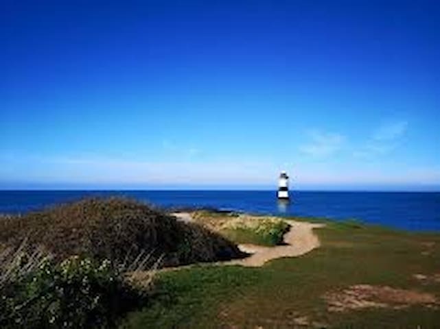
South Stack is set in a spectacular location to the north-west of Holyhead.
The lighthouse acts as a waymark for coastal traffic and a landmark and orientation light for vessels crossing the Irish Sea to and from the ports of Holyhead and Dun Laoghaire. You can now experience the Lighthouse Tour having followed the keeper's journey down the 400 steps on to the island and view the fascinating geology of the surrounding cliffs.
108 íbúar mæla með
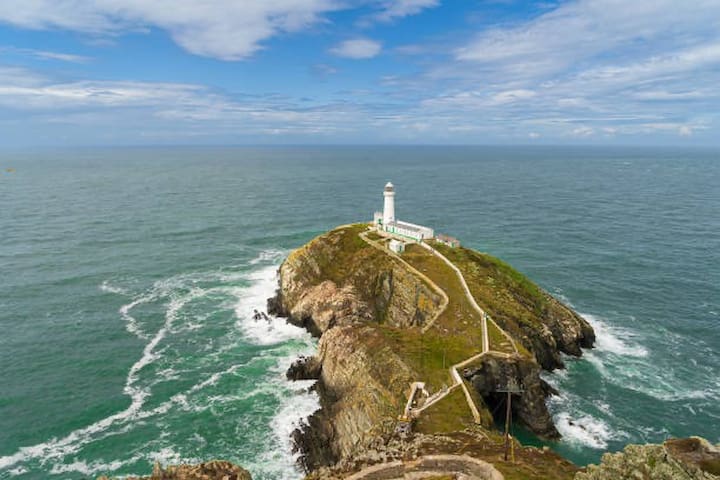
South Stack Lighthouse
South Stack is set in a spectacular location to the north-west of Holyhead.
The lighthouse acts as a waymark for coastal traffic and a landmark and orientation light for vessels crossing the Irish Sea to and from the ports of Holyhead and Dun Laoghaire. You can now experience the Lighthouse Tour having followed the keeper's journey down the 400 steps on to the island and view the fascinating geology of the surrounding cliffs.
Holyhead Breakwater is situated at the north-western end of Holyhead on the Island of Anglesey was built to provide shelter to the body of water at the North Western end of Holyhead, this was in addition to the harbour which already existed at Holyhead.
The breakwater at Holyhead is a staggering 1.7 miles long, the longest in Europe and is not only very pleasant to walk along as it has a promenade but extremely popular with fishing and various competitions take place throughout the year from this excellent fishing location.
6 íbúar mæla með
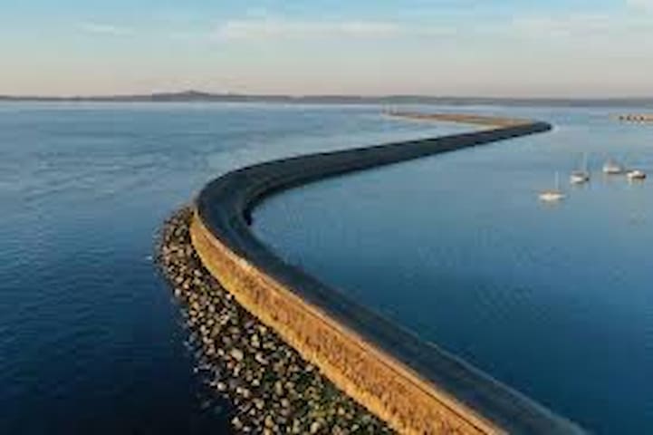
Holyhead Breakwater
Holyhead Breakwater is situated at the north-western end of Holyhead on the Island of Anglesey was built to provide shelter to the body of water at the North Western end of Holyhead, this was in addition to the harbour which already existed at Holyhead.
The breakwater at Holyhead is a staggering 1.7 miles long, the longest in Europe and is not only very pleasant to walk along as it has a promenade but extremely popular with fishing and various competitions take place throughout the year from this excellent fishing location.
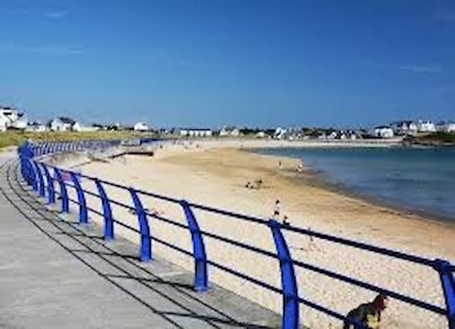
Winner of of the Green Coast seaside award, Rhosneigr lies on Anglesey’s Western shore.
With its two broad, sandy beaches, Traeth Crigyll and Traeth Llydan, it is a popular centre for all watersports.
Rhosneigr is superb for walking on the beach, with rocky outcrops and dramatic sand dunes. Also nearby is Llyn Maelog with it all access boardwalk for those wanting to watch nature.
63 íbúar mæla með
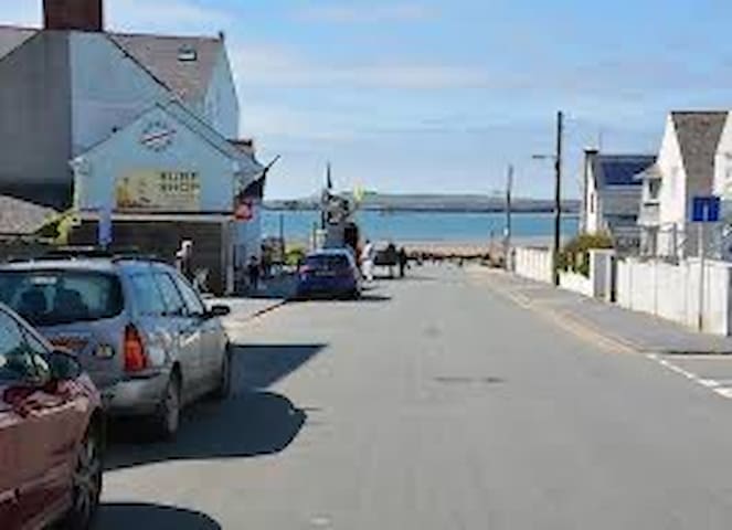
Rhosneigr
Winner of of the Green Coast seaside award, Rhosneigr lies on Anglesey’s Western shore.
With its two broad, sandy beaches, Traeth Crigyll and Traeth Llydan, it is a popular centre for all watersports.
Rhosneigr is superb for walking on the beach, with rocky outcrops and dramatic sand dunes. Also nearby is Llyn Maelog with it all access boardwalk for those wanting to watch nature.
eaumaris is a captivating seaside town, with its mix of medieval, Georgian, Victorian and Edwardian architecture.
Its name is based on the Norman ‘beau marais’, meaning ‘fair marsh’, a description of the site chosen by Edward 1 for the last of his ‘Iron ring’ of castles, constructed in his bid to control the Welsh.
A ‘must’ is to take a walk through the town, starting with a stroll along the seafront, taking in the pier and the views over the Menai Strait and Snowdonia then continuing through the charming streets with their picturesque cottages, many painted in soft pastel colours.
Beaumaris castle is a United Nations World Heritage site and was constructed between 1295-1330 to form perfectly symmetrical concentric lines of fortification. There also a moat and a dock for access by supply ships.
Beaumaris has lively cafês, pubs, restaurants and hotels, with good food to suit every taste, and some excellent shopping marked by quality independent traders.
128 íbúar mæla með
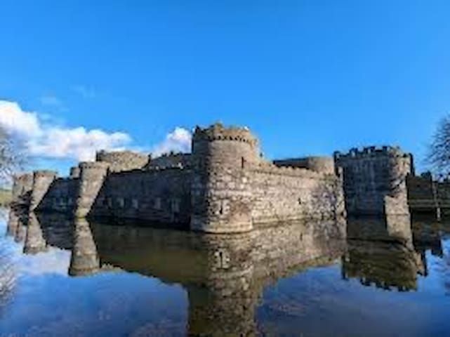
Beaumaris
eaumaris is a captivating seaside town, with its mix of medieval, Georgian, Victorian and Edwardian architecture.
Its name is based on the Norman ‘beau marais’, meaning ‘fair marsh’, a description of the site chosen by Edward 1 for the last of his ‘Iron ring’ of castles, constructed in his bid to control the Welsh.
A ‘must’ is to take a walk through the town, starting with a stroll along the seafront, taking in the pier and the views over the Menai Strait and Snowdonia then continuing through the charming streets with their picturesque cottages, many painted in soft pastel colours.
Beaumaris castle is a United Nations World Heritage site and was constructed between 1295-1330 to form perfectly symmetrical concentric lines of fortification. There also a moat and a dock for access by supply ships.
Beaumaris has lively cafês, pubs, restaurants and hotels, with good food to suit every taste, and some excellent shopping marked by quality independent traders.
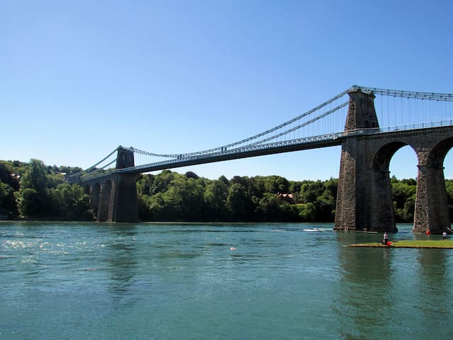
Situated on the banks of the Menai Strait, Menai Bridge’s two impressive bridges provide Anglesey’s physical links with the mainland.
Thomas Telford’s Menai Suspension bridge (Pont Menai), Opened in 1826. The World’s first iron suspension bridge, it is 1,265 feet/305m long, with a central span of 579 feet/177m with its roadway set 98m/30m above the water to allow tall ships to sail beneath. The Britannia Bridge (Pont Britannia). Opened in 1850. Is a magnificent prototype box-girder design by William Fairbairn and Robert Stephenson. Originally built to carry rail traffic, this bridge was converted to a double-decked structure following a catastrophic fire in 1970. It now carries both rail and road traffic.
A short walk from Menai Bridge town centre brings the visitor to the base of the Menai Suspension Bridge, from where the true scale of this remarkable structure is best appreciated. The Belgium Promenade (built by Flemish refugees from the Great War between 1914-16) leads south west from here shortly reaching a causeway that links Church island and the ancient Church of St Tysilio to the shore. A short walk around the church cemetery affords wonderful views of the Menai Strait, both bridges and Ynys Gorad Goch island, whose residents once made a living from the fish caught at the traps built there.
Menai bridge has a selection of interesting shops, including antiques, books and ironmongers. There is a good collection of pubs and restaurants catering for all tastes, including local seafood.
89 íbúar mæla með
Menai Bridge
A5Situated on the banks of the Menai Strait, Menai Bridge’s two impressive bridges provide Anglesey’s physical links with the mainland.
Thomas Telford’s Menai Suspension bridge (Pont Menai), Opened in 1826. The World’s first iron suspension bridge, it is 1,265 feet/305m long, with a central span of 579 feet/177m with its roadway set 98m/30m above the water to allow tall ships to sail beneath. The Britannia Bridge (Pont Britannia). Opened in 1850. Is a magnificent prototype box-girder design by William Fairbairn and Robert Stephenson. Originally built to carry rail traffic, this bridge was converted to a double-decked structure following a catastrophic fire in 1970. It now carries both rail and road traffic.
A short walk from Menai Bridge town centre brings the visitor to the base of the Menai Suspension Bridge, from where the true scale of this remarkable structure is best appreciated. The Belgium Promenade (built by Flemish refugees from the Great War between 1914-16) leads south west from here shortly reaching a causeway that links Church island and the ancient Church of St Tysilio to the shore. A short walk around the church cemetery affords wonderful views of the Menai Strait, both bridges and Ynys Gorad Goch island, whose residents once made a living from the fish caught at the traps built there.
Menai bridge has a selection of interesting shops, including antiques, books and ironmongers. There is a good collection of pubs and restaurants catering for all tastes, including local seafood.
Llanddwyn is not quite an island as it remains attached to the mainland at all but the highest tides. It provides excellent views of Snowdonia and the Llyn Peninsula and is part of the Newborough Warren National Nature Reserve.
Llanddwyn Island is located at the far end of the beach near Newborough Warren. This narrow finger of land is an ideal picnic site during fine weather, but also an exhilarating place when the winter winds blow. Its rolling dunes, large rock outcrops and mixture of historic buildings makes it an ideal place for an afternoon of exploration. A path leads to the nature reserve at Llanddwyn Island and nearby forest has great footpaths.
40 íbúar mæla með
Ynys Llanddwyn
Llanddwyn is not quite an island as it remains attached to the mainland at all but the highest tides. It provides excellent views of Snowdonia and the Llyn Peninsula and is part of the Newborough Warren National Nature Reserve.
Llanddwyn Island is located at the far end of the beach near Newborough Warren. This narrow finger of land is an ideal picnic site during fine weather, but also an exhilarating place when the winter winds blow. Its rolling dunes, large rock outcrops and mixture of historic buildings makes it an ideal place for an afternoon of exploration. A path leads to the nature reserve at Llanddwyn Island and nearby forest has great footpaths.
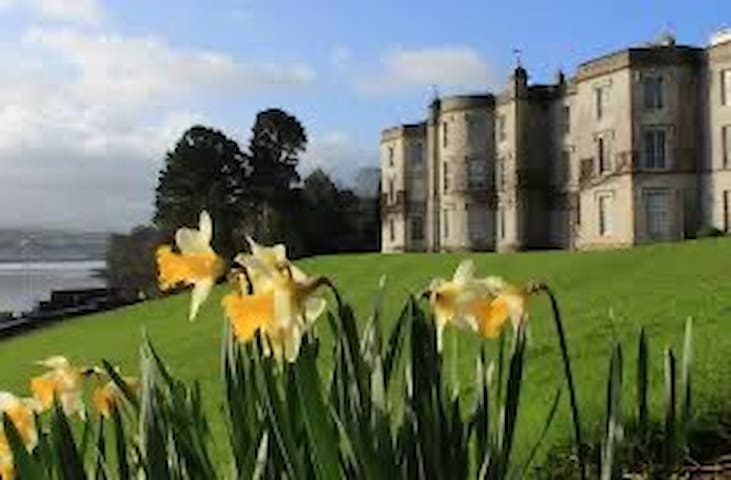
Enchanting mansion and gardens, with spectacular views of Snowdonia.
Llanfairpwll, Anglesey, LL61 6DQ
132 íbúar mæla með
National Trust - Plas Newydd hús og garðar
Enchanting mansion and gardens, with spectacular views of Snowdonia.
Llanfairpwll, Anglesey, LL61 6DQ
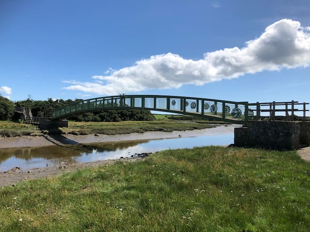
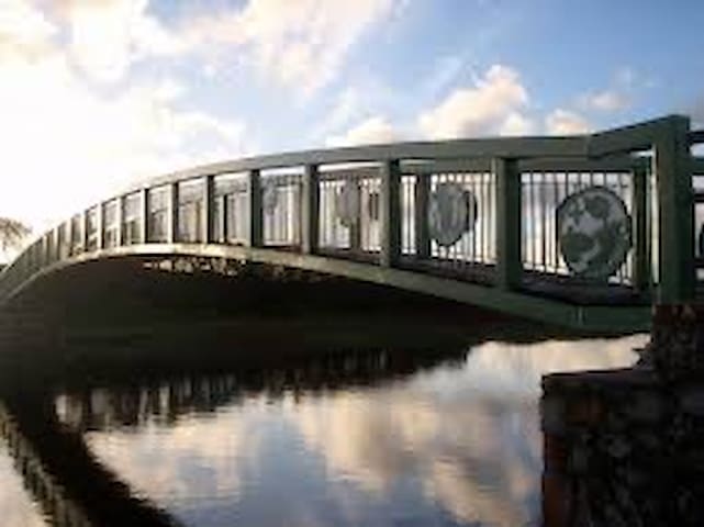
The new footbridge over the Afon Alaw now completes the Anglesey Coastal Path cutting 2 miles off the old route by avoiding having to walk along the A5025.
The artwork adorning the bridge was designed by artists Ann Catrin Evans and Catrin Meirion. They are made up of a series of shields depicting scenes of wildlife and scenes from the story of Branwen, from the Welsh folk tales 'Y Mabinogion'. There are strong links to this area and the tale claims that her resting place is on the banks of the Alaw estuary.
Within a walking distance from the site.
Afon Alaw
The new footbridge over the Afon Alaw now completes the Anglesey Coastal Path cutting 2 miles off the old route by avoiding having to walk along the A5025.
The artwork adorning the bridge was designed by artists Ann Catrin Evans and Catrin Meirion. They are made up of a series of shields depicting scenes of wildlife and scenes from the story of Branwen, from the Welsh folk tales 'Y Mabinogion'. There are strong links to this area and the tale claims that her resting place is on the banks of the Alaw estuary.
Within a walking distance from the site.
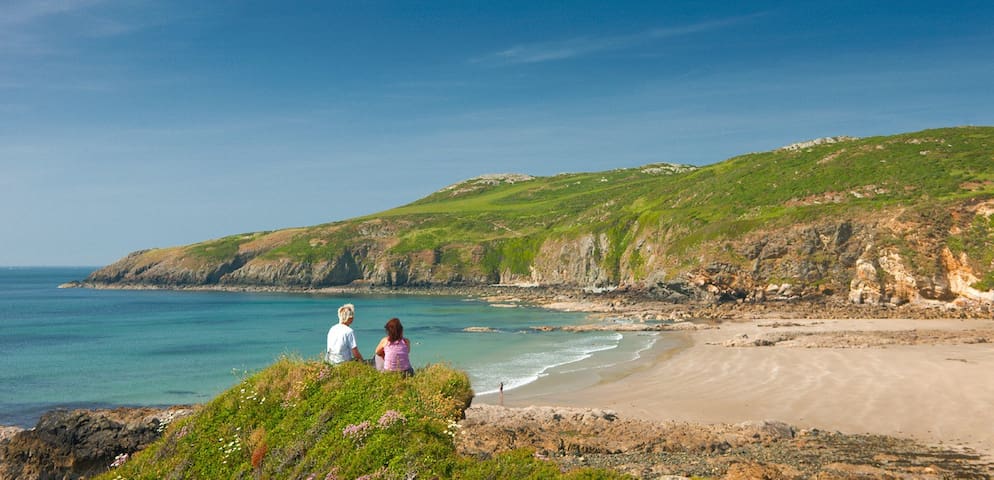
Penmon makes up Anglesey’s easternmost tip, jutting out into Conwy Bay. Puffin Island lies to the north east of Trwyn Penmon (Penmon headland), approximately half a mile offshore. The area’s stunning scenery and wildlife can be appreciated from its comprehensive public right of way network. The Anglesey Coastal Path follows the coastline from Penmon village and Caim, taking in the historical sites of Penmon Church and Priory, the 400 year old dovecote and the impressive deer park.
Puffin Island is not accessible to the public without the permission of the landowner, however there are boat trips around the island during the summer months from nearby Beaumaris. The whole area is very important for sea birds and waders, and Puffin Island has been designated as a Site of Special Scientific Interest (SSSI), and a Special Protection Area (SPA). It has a large sea bird colony, with considerable numbers of adults returning in the spring to breed. The dominant species include razorbills, shag, guillemots, kittiwakes, fulmars, herring gulls, lesser black-backed gulls, and great black-backed gulls. The area is of European importance for its breeding population of cormorant, and is also an important roosting area for oystercatchers. Puffins were once common on the island, although they are today quite scarce. On the occasions when they breed here, they lay their eggs in cracks between the rocks, as the island’s craggy substrate prevents them from digging burrows in which to nest, as is their more common habit. The coast and rocky shore supports many interesting and diverse marine communities, with a broad range of plants and animals, including seaweeds, lichen, molluscs, marine worms, sea squirts, sponges, crabs, anemones, and rock-boring animals. Grey seals can often be seen hauled out on the shore, and harbour porpoise can occasionally be spotted feeding in the tidal streams.
34 íbúar mæla með
Penmon Point
Penmon makes up Anglesey’s easternmost tip, jutting out into Conwy Bay. Puffin Island lies to the north east of Trwyn Penmon (Penmon headland), approximately half a mile offshore. The area’s stunning scenery and wildlife can be appreciated from its comprehensive public right of way network. The Anglesey Coastal Path follows the coastline from Penmon village and Caim, taking in the historical sites of Penmon Church and Priory, the 400 year old dovecote and the impressive deer park.
Puffin Island is not accessible to the public without the permission of the landowner, however there are boat trips around the island during the summer months from nearby Beaumaris. The whole area is very important for sea birds and waders, and Puffin Island has been designated as a Site of Special Scientific Interest (SSSI), and a Special Protection Area (SPA). It has a large sea bird colony, with considerable numbers of adults returning in the spring to breed. The dominant species include razorbills, shag, guillemots, kittiwakes, fulmars, herring gulls, lesser black-backed gulls, and great black-backed gulls. The area is of European importance for its breeding population of cormorant, and is also an important roosting area for oystercatchers. Puffins were once common on the island, although they are today quite scarce. On the occasions when they breed here, they lay their eggs in cracks between the rocks, as the island’s craggy substrate prevents them from digging burrows in which to nest, as is their more common habit. The coast and rocky shore supports many interesting and diverse marine communities, with a broad range of plants and animals, including seaweeds, lichen, molluscs, marine worms, sea squirts, sponges, crabs, anemones, and rock-boring animals. Grey seals can often be seen hauled out on the shore, and harbour porpoise can occasionally be spotted feeding in the tidal streams.
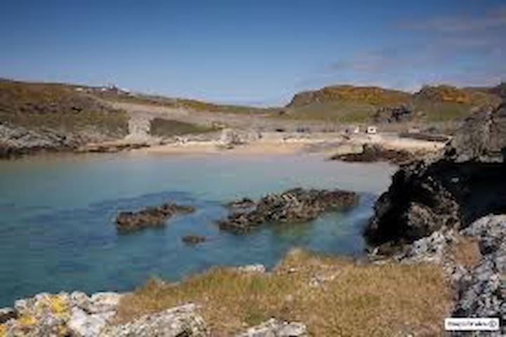
Porth Swtan / Church Bay is a beautiful rural and unspoilt sand and pebble beach edged with rock pools. The beach is backed by cliffs and access is via a steep footpath from the village which may cause difficulty for people with limited mobility. Swimming, sailing, fishing and surfing are all popular activities.
Porth Swtan
Porth Swtan / Church Bay is a beautiful rural and unspoilt sand and pebble beach edged with rock pools. The beach is backed by cliffs and access is via a steep footpath from the village which may cause difficulty for people with limited mobility. Swimming, sailing, fishing and surfing are all popular activities.
Penrhos Coastal Park
Access to the 200 acre park, situated on the outskirts of Holyhead is free! Penrhos Park is owned by Land and Lakes, it has been open for public use and enjoyment for over 30 years and is a very popular place for visits from locals and tourists alike.
3 miles from Glampio Bedo
Penrhos Beach Rd, Holyhead LL65, Bretland
Penrhos Coastal Park
Access to the 200 acre park, situated on the outskirts of Holyhead is free! Penrhos Park is owned by Land and Lakes, it has been open for public use and enjoyment for over 30 years and is a very popular place for visits from locals and tourists alike.
3 miles from Glampio Bedo
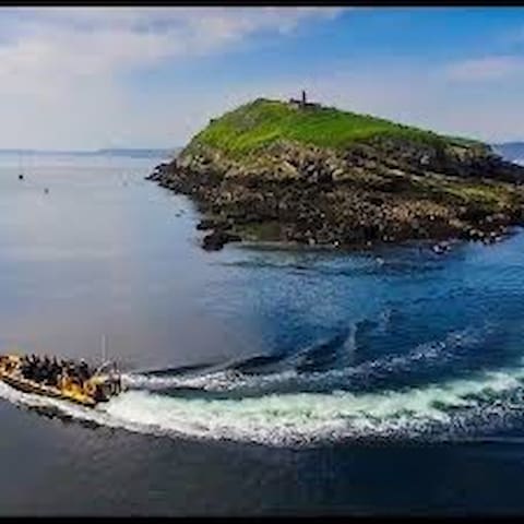
Puffin Island Cruises
Departing from Beaumaris heading towards the NE entrance of the Menai Straits we find Puffin Island, also known as Ynys Seiriol after the saint who founded a monastery on the island in the 6th century. Puffin Island is now a bird sanctuary and a nesting site for many species of breeding seabirds including guillemots, razorbill, puffins and kittiwakes from April to July. Other species such as cormorant and shags are on the island year round, Puffin Island also is also home to a colony of grey seals who normally have their pups in the autumn. You my even be lucky enough to encounter porpoise, on occasion dolphin can even be spotted.
10 íbúar mæla með
Starida Puffin Island Cruises and Sea Fishing Trips
Puffin Island Cruises
Departing from Beaumaris heading towards the NE entrance of the Menai Straits we find Puffin Island, also known as Ynys Seiriol after the saint who founded a monastery on the island in the 6th century. Puffin Island is now a bird sanctuary and a nesting site for many species of breeding seabirds including guillemots, razorbill, puffins and kittiwakes from April to July. Other species such as cormorant and shags are on the island year round, Puffin Island also is also home to a colony of grey seals who normally have their pups in the autumn. You my even be lucky enough to encounter porpoise, on occasion dolphin can even be spotted.
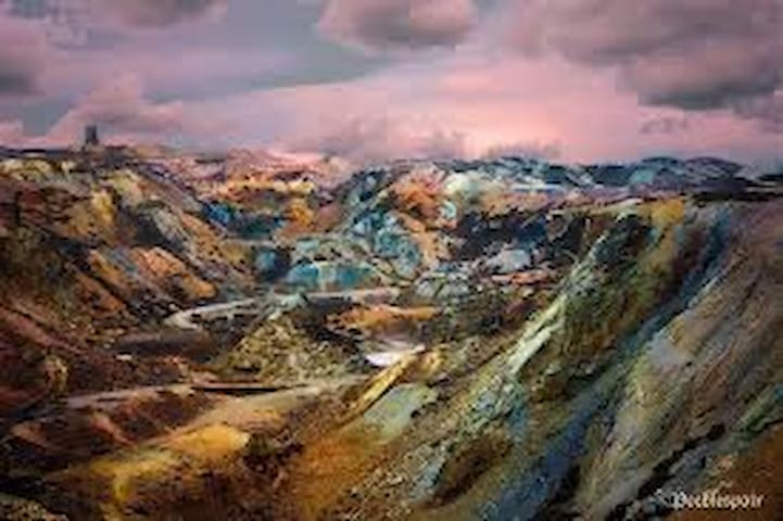
Parys Mountain is one of Anglesey’s must-visit locations! There is a network of walks around the weird landscape of the ancient copper mine at Parys Mountain.
A sight not to be missed is the spectacular Great Opencast – shaped by miners using nothing more than picks, shovels and gunpowder! There is a level walk around the top of the Great Opencast and a viewing area with a stunning panorama that shows off the excavation’s amazing colours - an artist’s palette of reds, oranges, pinks, browns, purples, blacks, greens, yellows, and greys.
People have mined the metals harboured within Parys Mountain since the Bronze Age. A mass of copper ore that was discovered there in the late 1760’s prompted large scale mining, with yields so great that Amlwch came to dominate the world copper market for a decade. It became known as the ‘Copper Kingdom’. The mine owner, Thomas Williams became known as the ‘Copper King’.
Even today, there is thought to be a reserve of about 6 million tonnes beneath the old mine workings. The dramatic, stony landscape appears barren, but it supports a variety of wildlife, including birds such as skylark, meadow pipit and chough. Plants that are able to tolerate high concentrations of copper and zinc are able to survive there.
The area has distant views of Snowdonia, with the peak of Mount Snowdon visible on clear days. There is nowhere quite like Parys Mountain! More information is contained within the Copper Kingdom booklet, published by the Amlwch Industrial Heritage Trust.
Parys Mountain, Amlwch LL68 9RE, Bretland
Parys Mountain is one of Anglesey’s must-visit locations! There is a network of walks around the weird landscape of the ancient copper mine at Parys Mountain.
A sight not to be missed is the spectacular Great Opencast – shaped by miners using nothing more than picks, shovels and gunpowder! There is a level walk around the top of the Great Opencast and a viewing area with a stunning panorama that shows off the excavation’s amazing colours - an artist’s palette of reds, oranges, pinks, browns, purples, blacks, greens, yellows, and greys.
People have mined the metals harboured within Parys Mountain since the Bronze Age. A mass of copper ore that was discovered there in the late 1760’s prompted large scale mining, with yields so great that Amlwch came to dominate the world copper market for a decade. It became known as the ‘Copper Kingdom’. The mine owner, Thomas Williams became known as the ‘Copper King’.
Even today, there is thought to be a reserve of about 6 million tonnes beneath the old mine workings. The dramatic, stony landscape appears barren, but it supports a variety of wildlife, including birds such as skylark, meadow pipit and chough. Plants that are able to tolerate high concentrations of copper and zinc are able to survive there.
The area has distant views of Snowdonia, with the peak of Mount Snowdon visible on clear days. There is nowhere quite like Parys Mountain! More information is contained within the Copper Kingdom booklet, published by the Amlwch Industrial Heritage Trust.
A beautiful large, sandy beach sloping to the sea. Rockpools and slipways.
This beach has a protected bathing area marked by buoys. Cafes, toilet facilities (including disabled), car parks and beach warden service.
Trearddur Bay, Bretland
A beautiful large, sandy beach sloping to the sea. Rockpools and slipways.
This beach has a protected bathing area marked by buoys. Cafes, toilet facilities (including disabled), car parks and beach warden service.
A lovely little south-west facing beach on Holy Island, Anglesey located to the west of Trearddur Bay.
13 íbúar mæla með
Porth Dafarch
Porthdafarch RoadA lovely little south-west facing beach on Holy Island, Anglesey located to the west of Trearddur Bay.
The park captures the scenic beauty, history and natural appeal of Anglesey all on one site and has a great deal to offer
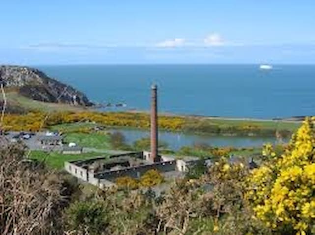
For an enjoyable day out in Anglesey's beautiful countryside visit the Holyhead Breakwater Country Park. It is situated next to the town and port of Holyhead - the Celtic gateway to Ireland.
Exhibitions - discover more about the wildlife and industrial heritage of the country park in the information centre (with audio-visual and interactive displays) and the outdoor exhibits.
Llyn Llwynog - where you can fish, watch the model boats or relax in the company of the moorhens and mallards.
The Rocky Coast - enjoy the stunning coastal scenery amongst the gorse and the heather.
Wildlife - Spot the chough and peregrine falcons as they swoop above the old quarries.
Walking - a variety of walks for all levels including access to Holyhead Mountain and South Stack.
Orienteering - try the orienteering course at Holyhead Breakwater Country Park.
Cafe available on site.
Children's play area.
The Holyhead Breakwater Country Park was opened in 1990 and is situated on the site of an old quarry which supplied stone for the 2.39km (1.5 miles) Holyhead Breakwater, the longest in Europe, which was built between 1846 and 1873. Part of the park is situated within an Area of Outstanding Natural Beauty (AONB).The park is managed by the Countryside Service of the Isle of Anglesey County Council. For more information please see the council website.
Wildlife
Breakwater Country Park is situated within a couple of miles of Holyhead town centre, and is easily accessible from there along the main road which hugs the coastline past the breakwater. The offshore islands that are visible on the horizon on a clear day are the Skerries, approximately 7 miles away.
The area was the source of the stone that was used to construct the breakwater. The park has a visitor centre, good parking facilities, and is well served by footpaths. The Anglesey Coastal Path runs through the reserve, following the coastline around Porth Namarch and on to North Stack and the fog signal station. The park’s nature trail is a good way to experience the area’s many different types of habitat and wildlife. Breakwater Country Park is a particularly good spot for migrant passerine birds in spring or autumn, as well as seabirds, and summer visitors like swallows and swifts. Inhabitants of the old quarries include the charismatic chough and the amazing peregrine falcon.
The heathland areas support a population of silver studded blue butterflies, and the reserve is home to many different species of moth, including the ruby tiger, cinnabar, buff tip and silver Y moth. The gorse and bramble scrub attracts willow warblers, stonechats, wheatears, and linnets, and little owls frequent the reserve – typically being seen more readily during the day than tawny and barn owls. There are many different types of orchid including bee orchid, marsh and common spotted orchid. The spring yields lovely displays of flowering thrift, spring squill and bird’s foot trefoil. The coast is a good place to watch for harbour porpoises, grey seals and Risso’s and common dolphins. The lakes are home to breeding moorhen and mallard, and grey herons can often be seen, standing stock still, waiting intently for fish-catching opportunities!
22 íbúar mæla með
Breakwater Country Park
The park captures the scenic beauty, history and natural appeal of Anglesey all on one site and has a great deal to offer
For an enjoyable day out in Anglesey's beautiful countryside visit the Holyhead Breakwater Country Park. It is situated next to the town and port of Holyhead - the Celtic gateway to Ireland.
Exhibitions - discover more about the wildlife and industrial heritage of the country park in the information centre (with audio-visual and interactive displays) and the outdoor exhibits.
Llyn Llwynog - where you can fish, watch the model boats or relax in the company of the moorhens and mallards.
The Rocky Coast - enjoy the stunning coastal scenery amongst the gorse and the heather.
Wildlife - Spot the chough and peregrine falcons as they swoop above the old quarries.
Walking - a variety of walks for all levels including access to Holyhead Mountain and South Stack.
Orienteering - try the orienteering course at Holyhead Breakwater Country Park.
Cafe available on site.
Children's play area.
The Holyhead Breakwater Country Park was opened in 1990 and is situated on the site of an old quarry which supplied stone for the 2.39km (1.5 miles) Holyhead Breakwater, the longest in Europe, which was built between 1846 and 1873. Part of the park is situated within an Area of Outstanding Natural Beauty (AONB).The park is managed by the Countryside Service of the Isle of Anglesey County Council. For more information please see the council website.
Wildlife
Breakwater Country Park is situated within a couple of miles of Holyhead town centre, and is easily accessible from there along the main road which hugs the coastline past the breakwater. The offshore islands that are visible on the horizon on a clear day are the Skerries, approximately 7 miles away.
The area was the source of the stone that was used to construct the breakwater. The park has a visitor centre, good parking facilities, and is well served by footpaths. The Anglesey Coastal Path runs through the reserve, following the coastline around Porth Namarch and on to North Stack and the fog signal station. The park’s nature trail is a good way to experience the area’s many different types of habitat and wildlife. Breakwater Country Park is a particularly good spot for migrant passerine birds in spring or autumn, as well as seabirds, and summer visitors like swallows and swifts. Inhabitants of the old quarries include the charismatic chough and the amazing peregrine falcon.
The heathland areas support a population of silver studded blue butterflies, and the reserve is home to many different species of moth, including the ruby tiger, cinnabar, buff tip and silver Y moth. The gorse and bramble scrub attracts willow warblers, stonechats, wheatears, and linnets, and little owls frequent the reserve – typically being seen more readily during the day than tawny and barn owls. There are many different types of orchid including bee orchid, marsh and common spotted orchid. The spring yields lovely displays of flowering thrift, spring squill and bird’s foot trefoil. The coast is a good place to watch for harbour porpoises, grey seals and Risso’s and common dolphins. The lakes are home to breeding moorhen and mallard, and grey herons can often be seen, standing stock still, waiting intently for fish-catching opportunities!
Restaurants
Great food and atmosphere 5 minutes away from Glampio Bedo in nearby Valley.
55 íbúar mæla með

Catch 22 Brasserie
Great food and atmosphere 5 minutes away from Glampio Bedo in nearby Valley.
Great food and atmosphere in Rhosneigr. 20 minutes away from Glampio Bedo.
29 íbúar mæla með
Sandy Mount House
High StreetGreat food and atmosphere in Rhosneigr. 20 minutes away from Glampio Bedo.
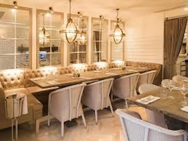
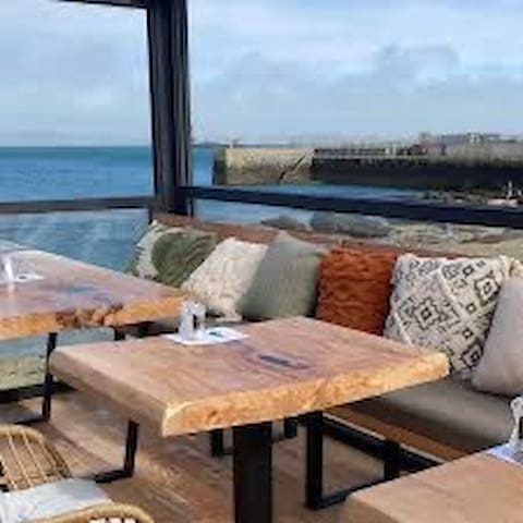
Ocean’s Edge Restaurant
Lon IsalltTrearddur Bay - 4.5 miles from Glampio Bedo
Great food and ice cream!
Trearddur Bay- 5 miles away from Glampio Bedo.
51 íbúar mæla með
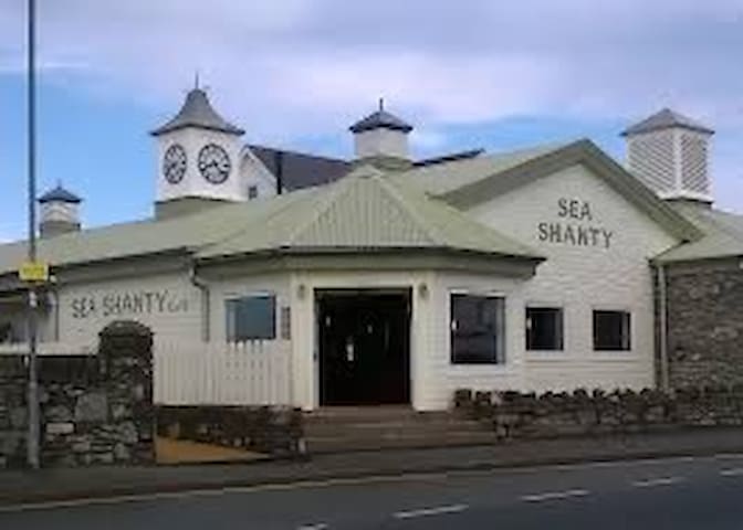
Sea Shanty Cafe
Lon St FfraidGreat food and ice cream!
Trearddur Bay- 5 miles away from Glampio Bedo.
Serving great seafood. 4 miles away from the site in Church Bay.
30 íbúar mæla með
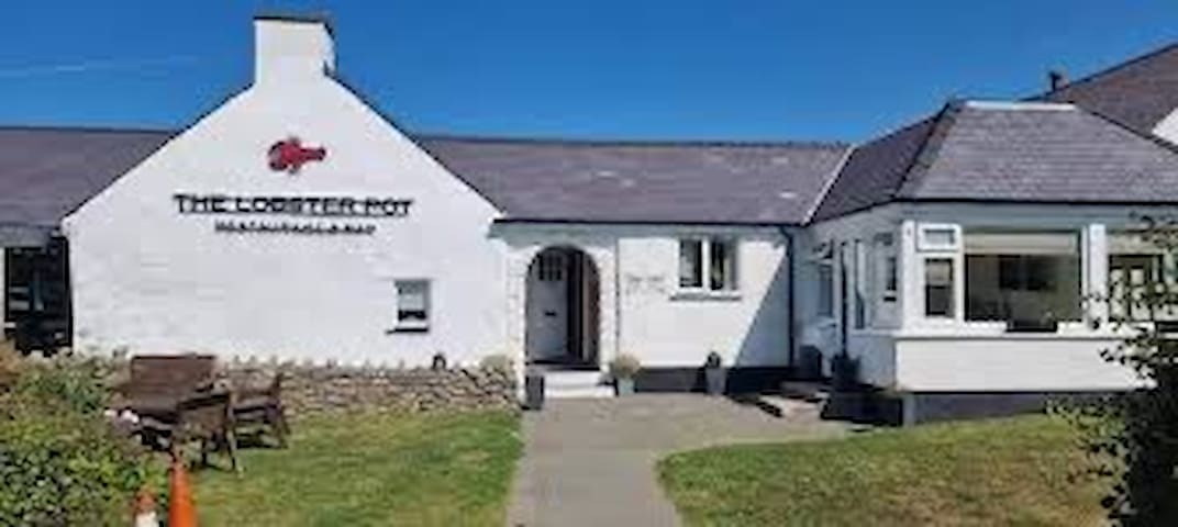
The Lobster Pot Restaurant
Serving great seafood. 4 miles away from the site in Church Bay.
The White Eagle has become a famous Anglesey landmark enjoyed by locals and tourists alike.
Great food and relaxing atmosphere after a walk along Rhoscolyn beautiful beach.
5 miles from Glampio Bedo.
58 íbúar mæla með
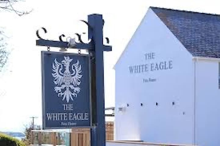
The White Eagle
The White Eagle has become a famous Anglesey landmark enjoyed by locals and tourists alike.
Great food and relaxing atmosphere after a walk along Rhoscolyn beautiful beach.
5 miles from Glampio Bedo.

Dylan's Menai Bridge
Saint George's RoadGreat food with stunning views of the Menai straits.
Stylish establishment with great food and views in nearby Holyhead.
8 íbúar mæla með
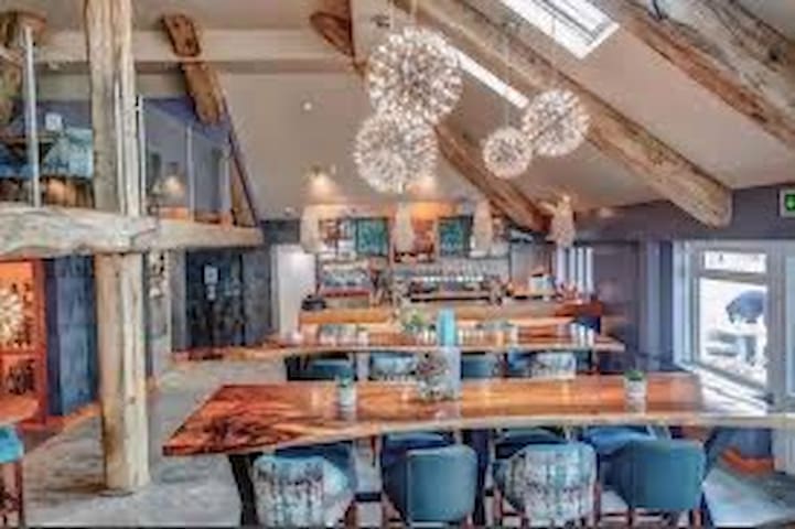
The Harbourfront Bistro
Stylish establishment with great food and views in nearby Holyhead.
Takeaway

Sunny Valley
London RoadChinese takeout in Valley. They will deliver to the site.
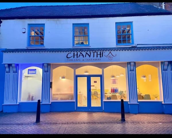
Chanthi's Thai to Go
4 Stanley StreetLovely thai takeaway in Holyhead
Great kebabs and pizza in Valley, 5 minutes away.
They offer a delivery service which is brilliant!
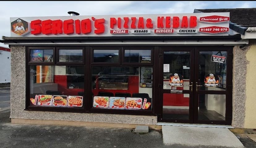
Sergios Kebab & Pizza Valley
Great kebabs and pizza in Valley, 5 minutes away.
They offer a delivery service which is brilliant!

Enochs Fish & Chips
Lovely fish and chips in nearby Valley.
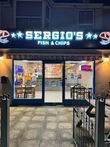
Sergio's Fish & Chips
Fish and chips take away in nearby Valley.
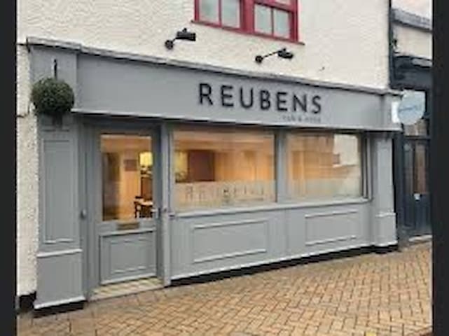
Reubens Cafe and Coffee
Great coffee shop in Holyhead

Y Glan-Neigr
Post Office LaneGreat Indian restaurant/take away.
15 minutes drive from Glampio Bedo in Rhosneigr.
Adventure
30 minutes away from the glamping site.
Located in the heart of the Snowdonia National Park, Zip World Penrhyn Quarry is home to exhilarating adventures, delicious, locally sourced food & drink, and some of the most incredible views North Wales has to offer.
The world's fastest and Europe's longest zip line, Velocity 2 is Zip World's best-known adventure, featuring four parallel lines that span 1.5 kilometres over the beautiful blue water of Penrhyn Quarry lake. It is the perfect group activity, as you and family, friends or colleagues race each other across the lake to see who gets to the other side first - reaching possible speeds of up to and over 100 mph!
475 íbúar mæla með

Zip World Penrhyn Quarry
Located in the heart of the Snowdonia National Park, Zip World Penrhyn Quarry is home to exhilarating adventures, delicious, locally sourced food & drink, and some of the most incredible views North Wales has to offer.
The world's fastest and Europe's longest zip line, Velocity 2 is Zip World's best-known adventure, featuring four parallel lines that span 1.5 kilometres over the beautiful blue water of Penrhyn Quarry lake. It is the perfect group activity, as you and family, friends or colleagues race each other across the lake to see who gets to the other side first - reaching possible speeds of up to and over 100 mph!
The most popular route to Snowdonia’s most iconic summit
The Llanberis Path is undoubtedly the most popular in the National Park. Over 600,000 people reach the summit of Yr Wyddfa (Snowdon) each year, and most walkers take the Llanberis Path to the peak.
As one of the six main routes to the summit of Yr Wyddfa (Snowdon), the Llanberis path is a popular choice for those who are climbing Yr Wyddfa (Snowdon) for the first time. While it’s the longest route, it does offer the most gradual climb to the peak.
Llanberis Pass
The most popular route to Snowdonia’s most iconic summit
The Llanberis Path is undoubtedly the most popular in the National Park. Over 600,000 people reach the summit of Yr Wyddfa (Snowdon) each year, and most walkers take the Llanberis Path to the peak.
As one of the six main routes to the summit of Yr Wyddfa (Snowdon), the Llanberis path is a popular choice for those who are climbing Yr Wyddfa (Snowdon) for the first time. While it’s the longest route, it does offer the most gradual climb to the peak.
RibRide along the Menai Strait. This 45 minute fun RIB experience will leave you feeling invigorated, as you travel along the Menai Strait at speeds of up to 35knts
78 íbúar mæla með
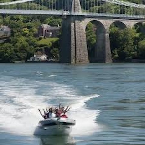
RibRide
Water StreetRibRide along the Menai Strait. This 45 minute fun RIB experience will leave you feeling invigorated, as you travel along the Menai Strait at speeds of up to 35knts
Set on the west coast of Anglesey, overlooking the Irish Sea and the Snowdonia mountain range beyond, Anglesey Circuit provides visitors with a challenging and exciting circuit in a breathtaking location.
With its remarkably smooth surface and a minimum width of 12 metres, the circuit is an outstanding venue for amateurs and professionals alike. Spectators can enjoy vantage points, including the elevated position above the Corkscrew, Peel and Rocket complex. The recently developed area from The Banking, through Church and beyond. Whether your preference is for two or four wheels, Anglesey Circuit will have something to offer.
19 íbúar mæla með

Anglesey Circuit
A4080Set on the west coast of Anglesey, overlooking the Irish Sea and the Snowdonia mountain range beyond, Anglesey Circuit provides visitors with a challenging and exciting circuit in a breathtaking location.
With its remarkably smooth surface and a minimum width of 12 metres, the circuit is an outstanding venue for amateurs and professionals alike. Spectators can enjoy vantage points, including the elevated position above the Corkscrew, Peel and Rocket complex. The recently developed area from The Banking, through Church and beyond. Whether your preference is for two or four wheels, Anglesey Circuit will have something to offer.
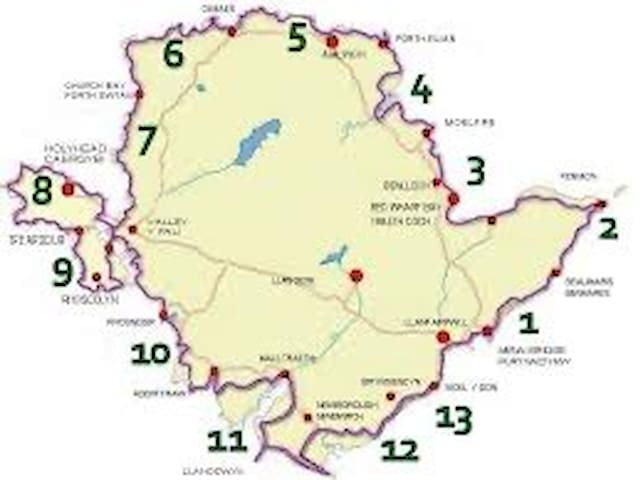
Isle of Anglesey Coastal Path
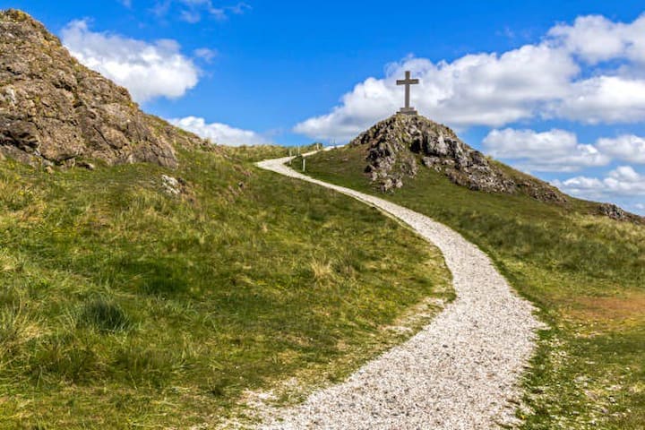
There are countless places worth visiting along the 140 mile/225km Anglesey Coast Path. It goes right round the island. The Friends of the Isle of Anglesey Coast Path website has handy maps and detailed descriptions of the path's 12 sections.
As well as skirting the spectacular coastline, the path passes through farmland, coastal heath, dunes and small pockets of woodland. Highlights include South Stack lighthouse, the sea arches at Bwa Gwyn and the wild flowers and birdlife at Aberffraw dunes.
25 íbúar mæla með
Isle of Anglesey Coastal Path
Isle of Anglesey Coastal Path
There are countless places worth visiting along the 140 mile/225km Anglesey Coast Path. It goes right round the island. The Friends of the Isle of Anglesey Coast Path website has handy maps and detailed descriptions of the path's 12 sections.
As well as skirting the spectacular coastline, the path passes through farmland, coastal heath, dunes and small pockets of woodland. Highlights include South Stack lighthouse, the sea arches at Bwa Gwyn and the wild flowers and birdlife at Aberffraw dunes.
Local attractions
Visit the Anglesey site where world-famous Halen Môn sea salt is made
Step inside Halen Môn's factory to discover how the company transforms Welsh seawater into a world-famous seasoning, sample a selection of surprising salt-infused products, and even take a dip in a seaweed bath. Willy Wonka eat your heart out.
41 íbúar mæla með
Halen Môn - Anglesey Sea Salt Company
Visit the Anglesey site where world-famous Halen Môn sea salt is made
Step inside Halen Môn's factory to discover how the company transforms Welsh seawater into a world-famous seasoning, sample a selection of surprising salt-infused products, and even take a dip in a seaweed bath. Willy Wonka eat your heart out.
Melin Llynon is run by Richard Holt and his family. Richard is an Anglesey native and was previously Marcus Wareing's Head Pastry Chef in London.
In 2019, he took ownership of the windmill to save it from closure and now runs one of Anglesey's most charming family attractions, chocolate factory and donut shop with his family.
Mônuts are handmade every day at Melin Llynon by Richard Holt and his small team.
2.2 miles from Glampio Bedo.
44 íbúar mæla með

Melin Llynon, Llanddeusant
Melin Llynon is run by Richard Holt and his family. Richard is an Anglesey native and was previously Marcus Wareing's Head Pastry Chef in London.
In 2019, he took ownership of the windmill to save it from closure and now runs one of Anglesey's most charming family attractions, chocolate factory and donut shop with his family.
Mônuts are handmade every day at Melin Llynon by Richard Holt and his small team.
2.2 miles from Glampio Bedo.
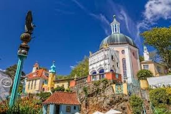
Created by Welsh architect Sir Clough Williams-Ellis, Portmeirion Village was designed to show how a naturally beautiful site could be developed without spoiling it. Williams-Ellis acquired the site in 1925 and worked to complete his grand vision over the next 50 years, completing the Village as we know it today in 1976.
Clough hoped that his creation would inspire others.
1 hour away from Glampio Bedo.
383 íbúar mæla með
Portmeirion
Created by Welsh architect Sir Clough Williams-Ellis, Portmeirion Village was designed to show how a naturally beautiful site could be developed without spoiling it. Williams-Ellis acquired the site in 1925 and worked to complete his grand vision over the next 50 years, completing the Village as we know it today in 1976.
Clough hoped that his creation would inspire others.
1 hour away from Glampio Bedo.
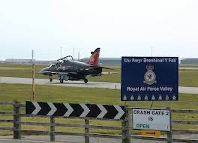
RAF Valley on Anglesey is home to No 4 Flying Training School, responsible for training the UK's next generation of world-class fighter pilots.
Aircrew are also trained at RAF Valley for mountain and maritime operations throughout the world.
RAF Valley is also home to the Mountain Rescue Service, the military's only high readiness, all weather search and rescue, aircraft post-crash management asset.
RAF Valley
Minffordd RoadRAF Valley on Anglesey is home to No 4 Flying Training School, responsible for training the UK's next generation of world-class fighter pilots.
Aircrew are also trained at RAF Valley for mountain and maritime operations throughout the world.
RAF Valley is also home to the Mountain Rescue Service, the military's only high readiness, all weather search and rescue, aircraft post-crash management asset.
As a purpose built museum, arts and events gallery, Oriel Môn has so much to offer.
A trip to Oriel Môn, the largest museum and art gallery in North Wales, provides an exceptional day out for all the family. Within its walls, visitors can experience what the Isle of Anglesey has to offer through a wide range of exciting exhibitions, activities and events, all free of charge.
The Oriel is home to ‘Oriel Kyffin Williams’, a gallery dedicated to Wales’ most prominent and well- loved artist. The Museum at the Oriel also houses the ‘Charles Tunnicliffe Gallery’. Visitors from far and wide flock here to see the wonderful work by the famous wildlife artist who made his home by the beautiful Malltraeth Estuary.
Rhosmeirch
Llangefni
Ynys Môn
LL77 7TQ
33 íbúar mæla með

Oriel Môn
As a purpose built museum, arts and events gallery, Oriel Môn has so much to offer.
A trip to Oriel Môn, the largest museum and art gallery in North Wales, provides an exceptional day out for all the family. Within its walls, visitors can experience what the Isle of Anglesey has to offer through a wide range of exciting exhibitions, activities and events, all free of charge.
The Oriel is home to ‘Oriel Kyffin Williams’, a gallery dedicated to Wales’ most prominent and well- loved artist. The Museum at the Oriel also houses the ‘Charles Tunnicliffe Gallery’. Visitors from far and wide flock here to see the wonderful work by the famous wildlife artist who made his home by the beautiful Malltraeth Estuary.
Rhosmeirch
Llangefni
Ynys Môn
LL77 7TQ
Llanfachraeth/Our village
Llanfachraeth is a village and community in the Welsh county of Anglesey. It is located near the west coast of the island, at the head of the Alaw estuary, 6.2 miles east of Holyhead, 11.7 miles south west of Amlwch and 11.3 miles north west of Llangefni. The A5025 road runs through the village.
Llanfachraeth
Within a walking distance from the glamping site if you fancy a drink or two before relaxing in your hot tub!!

Gwesty Holland Hotel
Valley roadWithin a walking distance from the glamping site if you fancy a drink or two before relaxing in your hot tub!!

Llanfachraeth Post Office
Post Office/shop
Within a walking distance from the glamping site.