
I consigli di anapama
luogo preferito per spuntino o colazione dolce e salato
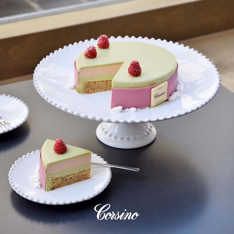
La pasticceria Corsino nasce nel 1868, e alla base della sua produzione di dolci e salati c'è la qualità. Suggeriamo questa pasticceria storica in quanto è stata selezionata come una delle migliori pasticceria d'Italia ma anche per la sua varietà di prodotti, per la sua ospitalità ma soprattutto per la bontà e la scelta di materie prime d'eccellenza.
8 íbúar mæla með
Corsino
2 Via NazionaleLa pasticceria Corsino nasce nel 1868, e alla base della sua produzione di dolci e salati c'è la qualità. Suggeriamo questa pasticceria storica in quanto è stata selezionata come una delle migliori pasticceria d'Italia ma anche per la sua varietà di prodotti, per la sua ospitalità ma soprattutto per la bontà e la scelta di materie prime d'eccellenza.
Offerta gastronomica
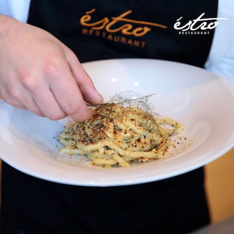
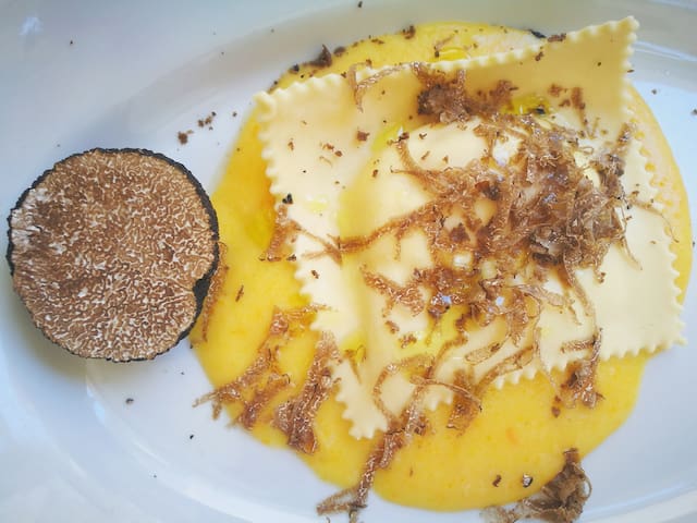
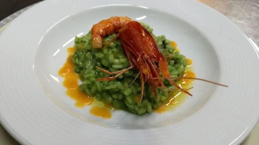
Ristorante ma anche pizzeria da un design minimal. Consiglio questo ristorante per la ricercatezza dei piatti e per gustare la cucina ed i sapori iblei con delle piccole rivisitazioni. Ottimo posto per poter fare un buon aperitivo con una visuale mozzafiato che si affaccia sulla valle. I piatti che vi consiglio sono l'uovo al tartufo, fiori di zucca ripieni fritti, la cheesecake, tagliolino al tartufo con guanciale di maiale e burro affumicato e per quanto riguarda il vino hanno un buon assortimento di vini locali e non solo.
Estro Restaurant
11 Via Martiri di Via FaniRistorante ma anche pizzeria da un design minimal. Consiglio questo ristorante per la ricercatezza dei piatti e per gustare la cucina ed i sapori iblei con delle piccole rivisitazioni. Ottimo posto per poter fare un buon aperitivo con una visuale mozzafiato che si affaccia sulla valle. I piatti che vi consiglio sono l'uovo al tartufo, fiori di zucca ripieni fritti, la cheesecake, tagliolino al tartufo con guanciale di maiale e burro affumicato e per quanto riguarda il vino hanno un buon assortimento di vini locali e non solo.
Locale ed ambiente da vera trattoria tradizionale con personale gentile, ospitale e molto disponibile. Consigliamo questa trattoria per l'ottima qualità-prezzo e per la tradizione culinaria mantenuta.
Assolutamente da provare l'antipasto misto, ravioli al sugo di maiale e come dolce il raviolino di ricotta fritto, ma anche tutto il resto non è da sottovalutare.
12 íbúar mæla með
Trattoria del Gallo
228 Via RomaLocale ed ambiente da vera trattoria tradizionale con personale gentile, ospitale e molto disponibile. Consigliamo questa trattoria per l'ottima qualità-prezzo e per la tradizione culinaria mantenuta.
Assolutamente da provare l'antipasto misto, ravioli al sugo di maiale e come dolce il raviolino di ricotta fritto, ma anche tutto il resto non è da sottovalutare.
The "Scrigno dei Sapori" restaurant was born in November 2007 from the chef's dream Paolo Didomenico, to want to welcome his customers in a simple and refined environment, to rediscover and taste the lost flavors of the local and Sicilian tradition , both of meat and fish , with his characteristic touch of innovation and genius.
The dishes of the Iblean tradition, the historic Sicilian cheeses, the veal meatballs, the octopus with passion fruit jelly, the inevitable ravioli with pork sauce and the traditional sausage of Palazzolo Acreid and - Slow Food presidium are among the most requested dishes. and appreciated by the Scrigno dei Sapori.
To accompany it all, a selection of wines from the best local and Sicilian wineries. To greet you, the small pastry shop awaits you, created following the Palazzolese tradition, with an addition of fantasy
Lo Scrigno dei Sapori Ristorante
50 Via MaddalenaThe "Scrigno dei Sapori" restaurant was born in November 2007 from the chef's dream Paolo Didomenico, to want to welcome his customers in a simple and refined environment, to rediscover and taste the lost flavors of the local and Sicilian tradition , both of meat and fish , with his characteristic touch of innovation and genius.
The dishes of the Iblean tradition, the historic Sicilian cheeses, the veal meatballs, the octopus with passion fruit jelly, the inevitable ravioli with pork sauce and the traditional sausage of Palazzolo Acreid and - Slow Food presidium are among the most requested dishes. and appreciated by the Scrigno dei Sapori.
To accompany it all, a selection of wines from the best local and Sicilian wineries. To greet you, the small pastry shop awaits you, created following the Palazzolese tradition, with an addition of fantasy
Visite turistiche
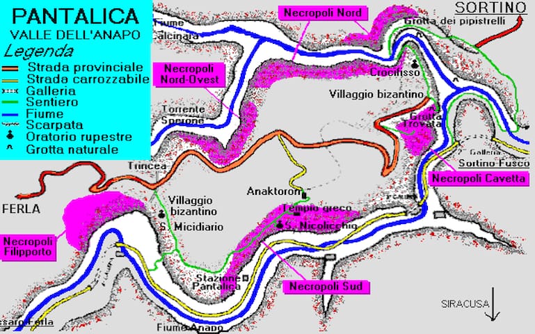
The Necropoli of Pantalica is a collection cemeteries with rock-cut chamber tombs in southest Sicily, Italy. Dating from 13th to the 7th centuries BC., there was thought to be over 5.000 tombs, although the most recent estimate suggests a figure of just under 4.000. They extend around the flanks of a large promontory located at the junction of the Anapo river with its tributary, the Calcinara, about 23 km northwest of syracuse. Together with the city of Syracuse, Pantalica was listed as a UNESCO World Heritage Site in 2005.
Pantalica is located on a limestone promontory surronded by a deep gorge formed by the Anapo and Calcinara rivers between the towns of Ferla and Sortino in south-eastern Sicily. In addition to its archaeological interst it is an important nature reserve, with variety of local flora and fauna and naturalcaves (notably the Bat Cavel). Various pathways facilitate visitors access, including a disused railway track along the Anapo valley bottom. The promontory van be accessed directly by car from Ferla or by walking down the old mule track from the parking place on the road from Sortino and crossing over the Calcinara stream.
Pantalica has five cemeteries spread over a large area:
THE NECROPOLIS OF FILIPORTO consists of almost 1000 tombs, located on the southwestern side of the promontory (accessed by road from Ferla). In the same area are the remains of a defensive rock-cutditch of later date (probably 4th century BC) traversing the promontory at its narrow est point.
THE NORTH WEST NECROPOLIS is one of the earliest (12th and 11th century BC), and is traversed by the tarmac road from Ferla.
THE CAVETTA NECROPOLIS has tombs and rock-cut houses of the prehistoric and later periods, and can be seen from the road and designated viewing platforms.
THE NORTH NECROPOLIS is a spectacular cemetery of about 1000 tombs covering very steep slopes overlooking the Calcinara river, best seen from the track coming from Sortino an from viewing the platforms near the path. Remains of large rock-cut dwelling are on the gentler slopes to the east
THE SOUTH NECROPOLIS extends along the Anapo river for over 1 km and is easily seen from the track way at the bottom of the valley. The old railway station ,restored, has information about local fauna and flora
The so-called Anaktoron(a Mycenaean princely palace) on the top of the hill is a multi-roomed building of large blocks, with various rectangular room, excavated in the 19th century by Paolo Orsi. Its origins are obscure but it was certainly used in byzantine period, as attested by roof tiles and pottery.
32 íbúar mæla með
Pantalica
Strada Provinciale 45The Necropoli of Pantalica is a collection cemeteries with rock-cut chamber tombs in southest Sicily, Italy. Dating from 13th to the 7th centuries BC., there was thought to be over 5.000 tombs, although the most recent estimate suggests a figure of just under 4.000. They extend around the flanks of a large promontory located at the junction of the Anapo river with its tributary, the Calcinara, about 23 km northwest of syracuse. Together with the city of Syracuse, Pantalica was listed as a UNESCO World Heritage Site in 2005.
Pantalica is located on a limestone promontory surronded by a deep gorge formed by the Anapo and Calcinara rivers between the towns of Ferla and Sortino in south-eastern Sicily. In addition to its archaeological interst it is an important nature reserve, with variety of local flora and fauna and naturalcaves (notably the Bat Cavel). Various pathways facilitate visitors access, including a disused railway track along the Anapo valley bottom. The promontory van be accessed directly by car from Ferla or by walking down the old mule track from the parking place on the road from Sortino and crossing over the Calcinara stream.
Pantalica has five cemeteries spread over a large area:
THE NECROPOLIS OF FILIPORTO consists of almost 1000 tombs, located on the southwestern side of the promontory (accessed by road from Ferla). In the same area are the remains of a defensive rock-cutditch of later date (probably 4th century BC) traversing the promontory at its narrow est point.
THE NORTH WEST NECROPOLIS is one of the earliest (12th and 11th century BC), and is traversed by the tarmac road from Ferla.
THE CAVETTA NECROPOLIS has tombs and rock-cut houses of the prehistoric and later periods, and can be seen from the road and designated viewing platforms.
THE NORTH NECROPOLIS is a spectacular cemetery of about 1000 tombs covering very steep slopes overlooking the Calcinara river, best seen from the track coming from Sortino an from viewing the platforms near the path. Remains of large rock-cut dwelling are on the gentler slopes to the east
THE SOUTH NECROPOLIS extends along the Anapo river for over 1 km and is easily seen from the track way at the bottom of the valley. The old railway station ,restored, has information about local fauna and flora
The so-called Anaktoron(a Mycenaean princely palace) on the top of the hill is a multi-roomed building of large blocks, with various rectangular room, excavated in the 19th century by Paolo Orsi. Its origins are obscure but it was certainly used in byzantine period, as attested by roof tiles and pottery.
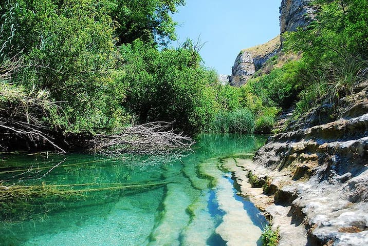
If you like nature, panoramic views and trekking you should have a trip to Cavagrande del Cassibile during your holiday in Sicily. It's a huge nature reserve which surrounds the canyon formed by the little Cassibile river. The Canyon is about 10 Km long and has steep stone walls, over 300 m high in some points. Cavagrande is located few kilometers from the little town of Avola, southern of Syracuse. The main access point to the canyon is the little road which passes near Avolaantica, a town destroyed by a terrible earthquake in the year 1693. It's not necessary to do a tiring excursion to enjoy beautiful panoramic views over the province of Syracuse till the sea or look down in the canyon to admire the little lakes and the curves of the little Cassibile river. Spring is a great season to visit the nature reserve because the temperatures are mild and the landscape is fullfilled with flowers. During the summer months it's also possible to have a bath in the fresh little lakes which are located at the base of the canyon. There are also archeological remains like the impressive "GrottadeiBriganti", or the prehistoric Cassibile necropolis, at the end of the canyon. There are a lot of pathways with different difficulty grades which permit the visit to Cavagrande. If you are visiting Cava Grande the first time, we suggest the "Scalacruci" pathway which starts at the Belvedere and arrives at the little lakes.
362 íbúar mæla með
Oriented Nature Reserve Cavagrande
SP4If you like nature, panoramic views and trekking you should have a trip to Cavagrande del Cassibile during your holiday in Sicily. It's a huge nature reserve which surrounds the canyon formed by the little Cassibile river. The Canyon is about 10 Km long and has steep stone walls, over 300 m high in some points. Cavagrande is located few kilometers from the little town of Avola, southern of Syracuse. The main access point to the canyon is the little road which passes near Avolaantica, a town destroyed by a terrible earthquake in the year 1693. It's not necessary to do a tiring excursion to enjoy beautiful panoramic views over the province of Syracuse till the sea or look down in the canyon to admire the little lakes and the curves of the little Cassibile river. Spring is a great season to visit the nature reserve because the temperatures are mild and the landscape is fullfilled with flowers. During the summer months it's also possible to have a bath in the fresh little lakes which are located at the base of the canyon. There are also archeological remains like the impressive "GrottadeiBriganti", or the prehistoric Cassibile necropolis, at the end of the canyon. There are a lot of pathways with different difficulty grades which permit the visit to Cavagrande. If you are visiting Cava Grande the first time, we suggest the "Scalacruci" pathway which starts at the Belvedere and arrives at the little lakes.
The Vendicari Nature Reserve was planned by a law of the Region of Sicily in 1981, but it was officially established in 1984, after numerous struggles of environmental groups and many bureaucratic steps.
The history of the reserve has very ancient origins. Various archaeological and architectural statements are from the establishment of the man since the Greek era.
Hellenistic Age
South of Eloro, not far from the beach Marianelli, there are some quarries (stone quarries) of the 5th century BC used in the ancient Greek city of Eloro for the construction of temples and monuments. By the sea, not far from the Sveva Tower, there are tanks for tuna processing, next to which a small necropolis was also discovered.
Inside the reserve, even a portion of the ancient via Elorina is visible, the connecting road between the colony of Eloro and Syracuse.
Byzantine Age
The complex of Byzantine is located in the south of Vendicari, today called “Cittadella dei Maccari”.
In this site you can admire the Trigona: a Byzantine Cuba, which like all the churches of the time, has a square layout with three apses, a dome top and an opening to the east so that, as per tradition, the full moon light could enter the building beginning in this way the Holy Easter.
At a small distance from the Byzantine Cuba there are several catacombs dating from the same period and some rests of houses, a sign of a densely populated area.
Medieval Age
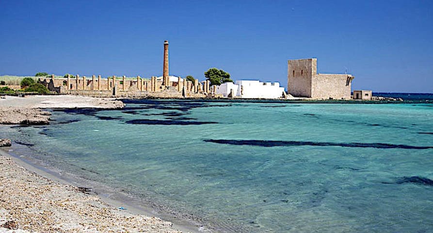
To this period belongs the most beautiful and visited construction of the Reserve: The Sveva Tower, probably built by Peter of Aragon, count of Albuquerque and duke of Noto (1406-1438). This fortification was required to report and repel attacks of Saracen pirates and Barbary, which with their constant raids systematically ransacked the inhabited centres and countryside of the island. During the centuries, the structure was reinforced and rebuilt, until it took the current form.The Sveva Tower was used until the 19th century, time of invention of the telegraph that made obsolete these defence systems.
Modern Age
Of “recent” construction, but no less charming, is the Tonnara of Vendicari: also called Bafatu, that was built in the 18th century following the large increase of concessions of tuna-fishing nets.
The activities of fishing tunas were facilitated by the presence of saltmines, the first dating back to the Greek era. Alternating between flourishing periods and closure ones, the tuna fishing system was completely renovated in 1914, thanks to the financial support of Antonino Modica Munafò, noble of Avola.
In 1943, after the landing of the allies, and because of insufficient economic performance of trading tunas, the tuna fishing closed its activities.
Today it remains a fascinating and unique proof of the traditional Sicilian Fisheries. Learn more about the Tonnara of Vendicari.
643 íbúar mæla með
Oasis í Vendicari náttúruverndarsvæði
Contrada VendicariThe Vendicari Nature Reserve was planned by a law of the Region of Sicily in 1981, but it was officially established in 1984, after numerous struggles of environmental groups and many bureaucratic steps.
The history of the reserve has very ancient origins. Various archaeological and architectural statements are from the establishment of the man since the Greek era.
Hellenistic Age
South of Eloro, not far from the beach Marianelli, there are some quarries (stone quarries) of the 5th century BC used in the ancient Greek city of Eloro for the construction of temples and monuments. By the sea, not far from the Sveva Tower, there are tanks for tuna processing, next to which a small necropolis was also discovered.
Inside the reserve, even a portion of the ancient via Elorina is visible, the connecting road between the colony of Eloro and Syracuse.
Byzantine Age
The complex of Byzantine is located in the south of Vendicari, today called “Cittadella dei Maccari”.
In this site you can admire the Trigona: a Byzantine Cuba, which like all the churches of the time, has a square layout with three apses, a dome top and an opening to the east so that, as per tradition, the full moon light could enter the building beginning in this way the Holy Easter.
At a small distance from the Byzantine Cuba there are several catacombs dating from the same period and some rests of houses, a sign of a densely populated area.
Medieval Age
To this period belongs the most beautiful and visited construction of the Reserve: The Sveva Tower, probably built by Peter of Aragon, count of Albuquerque and duke of Noto (1406-1438). This fortification was required to report and repel attacks of Saracen pirates and Barbary, which with their constant raids systematically ransacked the inhabited centres and countryside of the island. During the centuries, the structure was reinforced and rebuilt, until it took the current form.The Sveva Tower was used until the 19th century, time of invention of the telegraph that made obsolete these defence systems.
Modern Age
Of “recent” construction, but no less charming, is the Tonnara of Vendicari: also called Bafatu, that was built in the 18th century following the large increase of concessions of tuna-fishing nets.
The activities of fishing tunas were facilitated by the presence of saltmines, the first dating back to the Greek era. Alternating between flourishing periods and closure ones, the tuna fishing system was completely renovated in 1914, thanks to the financial support of Antonino Modica Munafò, noble of Avola.
In 1943, after the landing of the allies, and because of insufficient economic performance of trading tunas, the tuna fishing closed its activities.
Today it remains a fascinating and unique proof of the traditional Sicilian Fisheries. Learn more about the Tonnara of Vendicari.
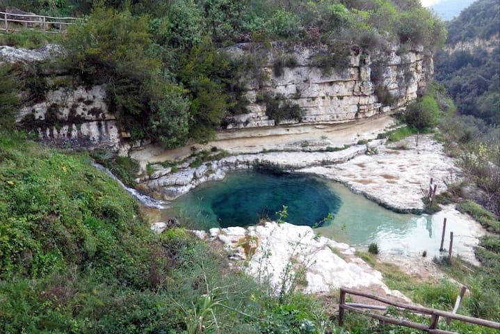
The cave of Carosello is found on the East of Noto Antica. In the past, the city of Noto had a valley, next to the water stream. Some of its industrial activities: leather making, are still visible and it made use of the water stream for making leather goods. Leather was an industrial Florence activity for Noto with a huge business of the 500 for the aristocrats of Noto. It was surely a strong environmental impact on the environment of tannin making, made in the river. Todays mills, tanneries have been abandoned and re-naturalized. The human activity in the cave has changed profoundly, mostly by hikers.
The cave is accessible from Ancient Noto “Noto Antica” down a mule track embedded into the rock, in the valley you will find the old tanneries and following the river it meet several “uruvi” ponds, roof pond. It’s very extraordinary and probably the last you will encounter of it’s time. A place for excursions and it’s definitely refreshing in the warmer seasons.
10 íbúar mæla með
Cava del Carosello
The cave of Carosello is found on the East of Noto Antica. In the past, the city of Noto had a valley, next to the water stream. Some of its industrial activities: leather making, are still visible and it made use of the water stream for making leather goods. Leather was an industrial Florence activity for Noto with a huge business of the 500 for the aristocrats of Noto. It was surely a strong environmental impact on the environment of tannin making, made in the river. Todays mills, tanneries have been abandoned and re-naturalized. The human activity in the cave has changed profoundly, mostly by hikers.
The cave is accessible from Ancient Noto “Noto Antica” down a mule track embedded into the rock, in the valley you will find the old tanneries and following the river it meet several “uruvi” ponds, roof pond. It’s very extraordinary and probably the last you will encounter of it’s time. A place for excursions and it’s definitely refreshing in the warmer seasons.
One of the most fascinating towns in Sicily, Ragusa has caused many a visitor’s jaw to drop as they first set eyes on it. Essentially Baroque, the Ragusa you will see today dates almost entirely from 1693, for it was in that year that Ragusa, along with its neighbours Noto, Modica, Scicli, and Catania, was razed to the ground by a terrible earthquake that hit most of the eastern side of Sicily.
Public opinion on where to rebuild the town was divided, and so a compromise was made. The wealthier, more aristocratic citizens built a new town in a different site, now Ragusa Superiore, while the other half of the population decided to rebuild on the original site, on a ridge at the bottom of a gorge, now known as Ragusa Ibla. The two towns remained separated until 1926 when they were merged to become the chief town of the province.
While the upper part of Ragusa has its fair share of architectural delights, it is the smaller Ragusa Ibla down below that really draws visitors. Whether you approach it from Modica to the south or from Ragusa Superiore, the sight of the jumble of houses, churches and civic palazzi piled on top of each other, clinging to the walls of the gorge, is really quite breathtaking. Although its built on an existing mediaeval plan, the town’s heart has a certain amount of baroque logic to it, and most of the buildings date from that period. From palazzolo to Ragusa there are 37,7 km (48 min.)
173 íbúar mæla með
Ragusa
One of the most fascinating towns in Sicily, Ragusa has caused many a visitor’s jaw to drop as they first set eyes on it. Essentially Baroque, the Ragusa you will see today dates almost entirely from 1693, for it was in that year that Ragusa, along with its neighbours Noto, Modica, Scicli, and Catania, was razed to the ground by a terrible earthquake that hit most of the eastern side of Sicily.
Public opinion on where to rebuild the town was divided, and so a compromise was made. The wealthier, more aristocratic citizens built a new town in a different site, now Ragusa Superiore, while the other half of the population decided to rebuild on the original site, on a ridge at the bottom of a gorge, now known as Ragusa Ibla. The two towns remained separated until 1926 when they were merged to become the chief town of the province.
While the upper part of Ragusa has its fair share of architectural delights, it is the smaller Ragusa Ibla down below that really draws visitors. Whether you approach it from Modica to the south or from Ragusa Superiore, the sight of the jumble of houses, churches and civic palazzi piled on top of each other, clinging to the walls of the gorge, is really quite breathtaking. Although its built on an existing mediaeval plan, the town’s heart has a certain amount of baroque logic to it, and most of the buildings date from that period. From palazzolo to Ragusa there are 37,7 km (48 min.)
Modica, an UNESCO heritage site since 2002, is a baroque city located in the south east of Sicily, in the province of Ragusa, in the "Val di Noto".
Walking through the elegant districts of Modica through the streets full of monuments and churches is a sight to be experienced at least once in a lifetime.
Among the various streets of the town you can pass in front of the birthplace (which became a museum) of Salvatore Quasimodo, Nobel Prize for literature! An unmissable place in Modica is the Clock Tower, located on the ruins of the ancient Counts Castle.
In addition to its great artistic and cultural heritage, Modica is famous today for something everyone loves: CHOCOLATE! Recognized in 2018 by the EU as a PGI product, it is prepared with an ancient recipe, which uses a lava stone mill specifically for the cold processing of cocoa beans.
There are many legends about the birth of this delicious recipe that makes “ciucculatta muricana” (as they say here) unique.
Some people say that Modica chocolate has Aztec origins, while others claim that it was refined with the addition of sugar only later by the Spanish. One thing is certain: visiting this beautiful city and eating or buying some chocolate is a must! There are many variations offered by the countless bars in Modica, try the versions with the addition of vanilla, cinnamon or chili.
From palazzolo to Modica there are 38,7km (47 min.)
436 íbúar mæla með
Modica
Modica, an UNESCO heritage site since 2002, is a baroque city located in the south east of Sicily, in the province of Ragusa, in the "Val di Noto".
Walking through the elegant districts of Modica through the streets full of monuments and churches is a sight to be experienced at least once in a lifetime.
Among the various streets of the town you can pass in front of the birthplace (which became a museum) of Salvatore Quasimodo, Nobel Prize for literature! An unmissable place in Modica is the Clock Tower, located on the ruins of the ancient Counts Castle.
In addition to its great artistic and cultural heritage, Modica is famous today for something everyone loves: CHOCOLATE! Recognized in 2018 by the EU as a PGI product, it is prepared with an ancient recipe, which uses a lava stone mill specifically for the cold processing of cocoa beans.
There are many legends about the birth of this delicious recipe that makes “ciucculatta muricana” (as they say here) unique.
Some people say that Modica chocolate has Aztec origins, while others claim that it was refined with the addition of sugar only later by the Spanish. One thing is certain: visiting this beautiful city and eating or buying some chocolate is a must! There are many variations offered by the countless bars in Modica, try the versions with the addition of vanilla, cinnamon or chili.
From palazzolo to Modica there are 38,7km (47 min.)
spiaggie
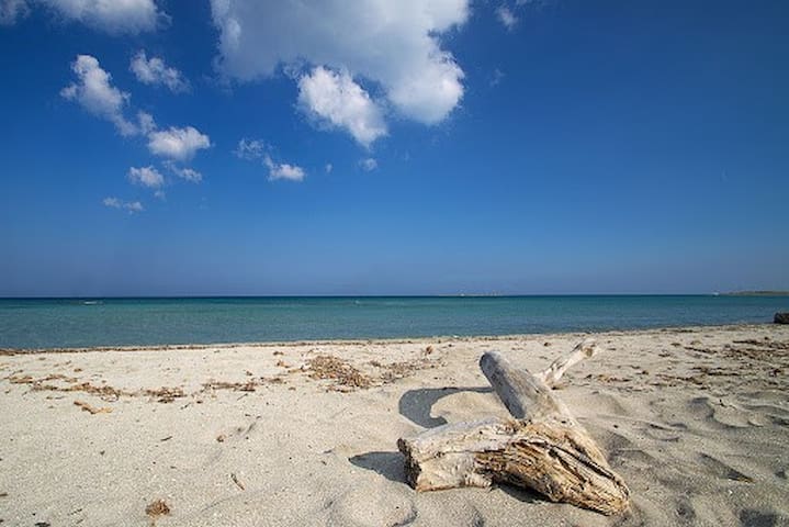
The Beach of Eloro is located in the northern part of the reserve of Vendicari, near the most popular tourist beaches of Noto.It can be easily reached from the motorway Siracusa-Gela. Following the indications you can reach the parking place in about 10 minutes from the exit of Noto.
To reach the beach you have to walk about 300 meters from the north entrance of the reserve, immediately next to the car park. Along the path you will notice some of the ruins of the Greek city of Eloro with descriptions and detailed reconstructions. After this short walk… Here you are!
In front of your eyes a large expanse of sand dunes, clear water and white sand, surrounded by Mediterranean scrub and quagmires of sweet water.
39 íbúar mæla með
Eloro Beach
Contrada EloroThe Beach of Eloro is located in the northern part of the reserve of Vendicari, near the most popular tourist beaches of Noto.It can be easily reached from the motorway Siracusa-Gela. Following the indications you can reach the parking place in about 10 minutes from the exit of Noto.
To reach the beach you have to walk about 300 meters from the north entrance of the reserve, immediately next to the car park. Along the path you will notice some of the ruins of the Greek city of Eloro with descriptions and detailed reconstructions. After this short walk… Here you are!
In front of your eyes a large expanse of sand dunes, clear water and white sand, surrounded by Mediterranean scrub and quagmires of sweet water.
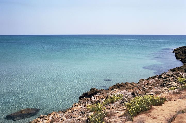
The beach of Marianelli is an isolated and unpolluted beach, inserted between almond trees, lemon trees and sand dunes enriched by a unique flora.
It is located in the northern area of the reserve between the beaches of Eloro and Calamosche.
It has shallow and clear waters and, in August, also warm.
As it is isolated, wild, and a little difficult to reach, its visitors are lovers of peace and privacy.
The beach hosts different types of “guests”, from the traditional weekend tourists, naturists, who were the first visitors, who love this beach and its cleaning… a valuable and pure place, which everyone should preserve and respect.
43 íbúar mæla með
Marianelli strönd
The beach of Marianelli is an isolated and unpolluted beach, inserted between almond trees, lemon trees and sand dunes enriched by a unique flora.
It is located in the northern area of the reserve between the beaches of Eloro and Calamosche.
It has shallow and clear waters and, in August, also warm.
As it is isolated, wild, and a little difficult to reach, its visitors are lovers of peace and privacy.
The beach hosts different types of “guests”, from the traditional weekend tourists, naturists, who were the first visitors, who love this beach and its cleaning… a valuable and pure place, which everyone should preserve and respect.
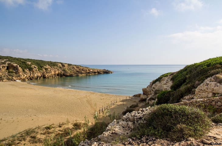
Caribbean? Kenyan beaches? No… We are in Calamosche, the most famous beach of the reserve of Vendicari.
Calamosche, better known by the inhabitants of the place as “Funni Musca” is a sandy little bay that extends for about 200 meters, delimited by two rocky headlands that act as shield to the currents, with the result of an always calm and clear sea.
A lovely natural swimming pool ideal for snorkelling. Swimming to the reef on the sides of the little glulf, where the seabed is more profound, caves, hollows and ravines host a varied marine life. Direct access to this beach is granted by a dedicated entrance, reachable from SP19. Once arrived at the equipped parking place, you have to walk in a path for about a kilometre. A small sacrifice amply rewarded once arrived, as soon as you will see an enchanting place, a natural paradise!
In 2005 it has been awarded by the Blue Guide of Legambiente with the title “most beautiful beach of Italy”.
224 íbúar mæla með
Calamosche Beach
Contrada VendicariCaribbean? Kenyan beaches? No… We are in Calamosche, the most famous beach of the reserve of Vendicari.
Calamosche, better known by the inhabitants of the place as “Funni Musca” is a sandy little bay that extends for about 200 meters, delimited by two rocky headlands that act as shield to the currents, with the result of an always calm and clear sea.
A lovely natural swimming pool ideal for snorkelling. Swimming to the reef on the sides of the little glulf, where the seabed is more profound, caves, hollows and ravines host a varied marine life. Direct access to this beach is granted by a dedicated entrance, reachable from SP19. Once arrived at the equipped parking place, you have to walk in a path for about a kilometre. A small sacrifice amply rewarded once arrived, as soon as you will see an enchanting place, a natural paradise!
In 2005 it has been awarded by the Blue Guide of Legambiente with the title “most beautiful beach of Italy”.
In the most southern part of Italy, where the Ionian Sea meets the Mediterranean Sea, depending on the tides, a stone tongue rises up, connecting Sicily with a beautiful little island.
This wild and unspoilt place is located near Portopalo di Capo Passaro, and our tip, if you want to visit the area, is to bring suitable shoes because the Ionian side of the beach is rocky.
If you want to visit the "Isola delle Correnti", located in front of the statue of Christ, you will inevitably get wet, although the path is easily practicable as the maximum depth is about 1.30 metres.
The island is not rich in any vegetation and has remained unpopulated, partly because it has been protected by environmental restrictions since 1987: there are only abandoned military residences and an impressive lighthouse, still in operation.
It has become a favourite destination for surfing and windsurfing enthusiasts: the foaming waves are perfect for anyone who wants to have fun surfing in Sicily!
This could be the right opportunity to start surfing, or at least enjoy the more experienced surfers, who always have a certain charm.
And then, try to dive into the beautiful blue sea of this coast, admiring with your own eyes the richness of the seabed! From Palazzolo to Isola delle correnti there are 60,6km (1h,05 min.)
115 íbúar mæla með
Isola delle Correnti
In the most southern part of Italy, where the Ionian Sea meets the Mediterranean Sea, depending on the tides, a stone tongue rises up, connecting Sicily with a beautiful little island.
This wild and unspoilt place is located near Portopalo di Capo Passaro, and our tip, if you want to visit the area, is to bring suitable shoes because the Ionian side of the beach is rocky.
If you want to visit the "Isola delle Correnti", located in front of the statue of Christ, you will inevitably get wet, although the path is easily practicable as the maximum depth is about 1.30 metres.
The island is not rich in any vegetation and has remained unpopulated, partly because it has been protected by environmental restrictions since 1987: there are only abandoned military residences and an impressive lighthouse, still in operation.
It has become a favourite destination for surfing and windsurfing enthusiasts: the foaming waves are perfect for anyone who wants to have fun surfing in Sicily!
This could be the right opportunity to start surfing, or at least enjoy the more experienced surfers, who always have a certain charm.
And then, try to dive into the beautiful blue sea of this coast, admiring with your own eyes the richness of the seabed! From Palazzolo to Isola delle correnti there are 60,6km (1h,05 min.)